Ludlow Massacre Memorial
USA /
Colorado /
Aguilar /
Route 44
World
/ USA
/ Colorado
/ Aguilar
memorial
Add category
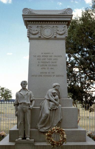
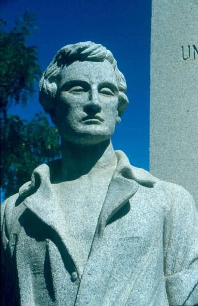
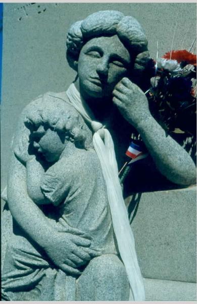
Memorial to the 2 women and 11 children killed when the National Guard opened fire on striking mine workers.
Wikipedia article: http://en.wikipedia.org/wiki/Ludlow_Monument
Nearby cities:
Coordinates: 37°20'21"N 104°35'2"W
- Pueblo Memorial Airport (PUB/KPUB) 108 km
- Ft Wallace (Site) 317 km
- Cal Black Memorial Airport 530 km
- Coronado National Memorial 842 km
- Kansas City Smartport, Former Richars-Gebaur AFB - Closed 893 km
- Neosho Hugh Robinson Airport (EOS/KEOS) 906 km
- Bear Creek Pioneers Park 1176 km
- Houston National Cemetery (USDVA) 1180 km
- Arkansas Post National Memorial 1250 km
- Gateway Arch National Park 1270 km
- Ludlow Tent Colony Site, Colorado 0.2 km
- San Isabel Solar Energy Center 10 km
- Spanish Peaks State Wildlife Area 21 km
- Camp Trinidad 22 km
- Perry Stokes Airport (TAD/KTAD) 23 km
- Maria Reservoir 38 km
- Peak View Wind Farm 38 km
- Gun Ranges 40 km
- Cantonment Area 42 km
- Pinon Canyon Maneuver Site 65 km