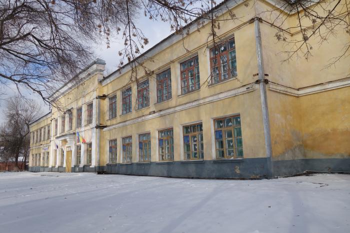
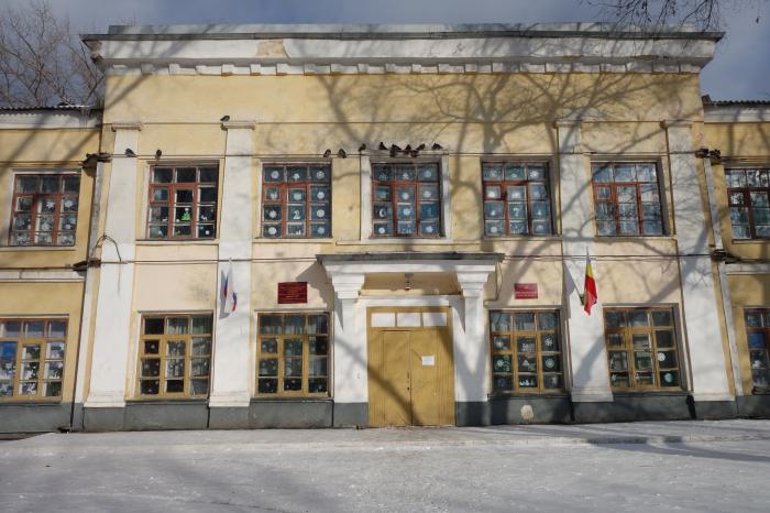
Territory of secondary school No.1 (Kamensk-Shakhtinsky)
Russia /
Rostov /
Kamensk-Shakhtinskiy /
Kamensk-Shakhtinsky
World
/ Russia
/ Rostov
/ Kamensk-Shakhtinskiy
, 2 km from center (Каменск-Шахтинский)
school yard, do not draw title
Nearby cities:
Coordinates: 48°19'13"N 40°16'42"E
- Territory of Boarding School No. 2 2.2 km
- Territory of secondary school No. 10 3.4 km
- Territory of Starostanichnaya secondary school 4.2 km
- Territory of Gusev secondary school 21 km
- School number 5 41 km
- School yard 192 km
- School yard 302 km
- Territory of the school 307 km
- Школа №6 337 km
- Territory of the school 359 km
- Ploshchad Platova ('Platov Square') 0.1 km
- Metochion of the Church of the Protection of Our Most Holy Theotokos 0.1 km
- Garages 0.2 km
- Walkway on Ukrainskaya ulitsa 0.3 km
- Perinatal Center (obstetric inpatient) of the Central City Hospital 0.6 km
- Kamensk-Shakhtinsky Central Municipal Hospital 0.7 km
- Sotsgorod historical residential area 0.8 km
- Schastlivy Kvartal ('Happy Block of Flats') low-rise residential compound 0.9 km
- Kosonogovka 1.8 km
- Mikrorayon Shestidesyatiletiya Oktyabrya 2.1 km
Ploshchad Platova ('Platov Square')
Metochion of the Church of the Protection of Our Most Holy Theotokos
Garages
Walkway on Ukrainskaya ulitsa
Perinatal Center (obstetric inpatient) of the Central City Hospital
Kamensk-Shakhtinsky Central Municipal Hospital
Sotsgorod historical residential area
Schastlivy Kvartal ('Happy Block of Flats') low-rise residential compound
Kosonogovka
Mikrorayon Shestidesyatiletiya Oktyabrya