Santa Clara Slough
Mexico /
Baja California /
Estaciyn Coahuila /
World
/ Mexico
/ Baja California
/ Estaciyn Coahuila
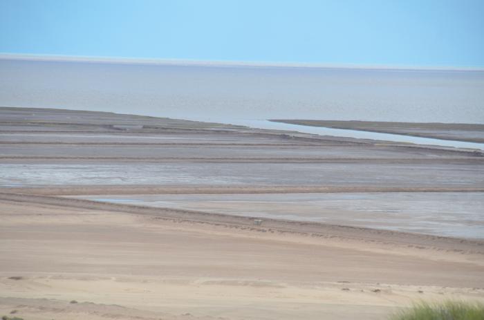
Santa Clara Slough is an old delta arm of the Colorado River. Old maps show the Slough extending from this location north thru the Cienega de Santa Clara, & connecting with the main channel of the Colorado just west of Ciudad Coahuila.
Map is here, at pg 1219:
books.google.com/books?id=MIRBAQAAIAAJ&lpg=PA1553&ots=S...
The Santa Clara Slough is also called the Santa Clara River in old navigation records.
Desc of the slough/river from the late 1800s:
"Santa Clara River, about 10 miles from the low point fronting Direction Sandhill, is only navigable at high water; at low-water springs [referring to a spring tide] it is dry, with the exception of here and there a pool of water.
The sand hills and table-lands, which up to this point have run parallel with the coast, here assume a more northerly direction, following the course of the Santa Clara river.
Santa Clara beacon is on the west side of the mouth of the river, and consists of a couple of piles with a piece of board nailed across the top."
books.google.com/books?id=OwUOAQAAIAAJ&printsec=frontco...
From: The West Coasts of Mexico and Central America. Chiefly from surveys by the United States Steamers Narragansett, Tuscarora, Ranger, and Thetis, between 1873 and 1901. at pg 155-156
1873 map of the delta is here:
fire.biol.wwu.edu/trent/alles/GeologySaltonTrough.pdf
at pg 20
Nearby cities:
Coordinates: 31°46'20"N 114°35'12"W
- Port Isabel 10 km
- La Ventana 46 km
- Eldorado Ranch - San Felipe Baja Norte Mexico 77 km
- San Felipe Marina Resort 90 km
- Punta Estrella 94 km
- The Reef RV park 105 km
- Playa Bonita RV Park 110 km
- Puerto Viejo 111 km
- Geysers, Onyx beds 222 km
- gonzaga bay 227 km
- Abandoned Maritech shrimp plant 4.9 km
- Pelican Island 5.7 km
- Colorado River Delta 11 km
- Gore Island 12 km
- Montague Island 14 km
- El Pinacate / Gran Desierto de Altar 45 km
- Active Gold Mine 54 km
- Salt Farming 55 km
- Shell Island 110 km
- Sierra de San Pedro Mártir National Park 112 km