Pedestrian Tunnel (No.4) (Nuneaton)
United Kingdom /
England /
Attleborough /
Nuneaton
World
/ United Kingdom
/ England
/ Attleborough
underpass
Add category

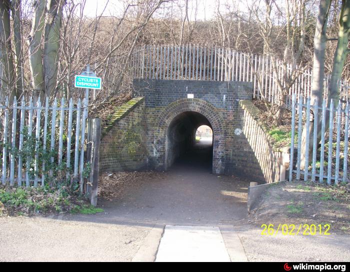
A pedestrian tunnel designated No.4. The Coventry to Nuneaton railway line spans over this tunnel.
Nearby cities:
Coordinates: 52°30'54"N 1°28'0"W
- Marble Arch subway complex (east) 143 km
- Marble Arch subway complex (south) - location for The Prisoner 143 km
- Greenwich Foot Tunnel 152 km
- underpass near Burghead drive 417 km
- Van Wyck Expressway - Union Turnpike Underpass 5443 km
- Van Wyck Expressway - Queens Blvd Underpass 5443 km
- Battery Park Underpass 5456 km
- Toronto PATH 5590 km
- Fletcher Avenue - I 275 Exit 6988 km
- San Martin Market 7443 km
- The Pingles Leisure Centre 0.3 km
- Pingles Sports Ground 0.5 km
- Middlemarch School Grounds 0.6 km
- Wem Brook 1 km
- Caldwell 1.3 km
- Hill Top 1.4 km
- Attleborough 1.4 km
- Chilvers Coton 2.7 km
- Arbury 3.4 km
- Warwickshire 23 km