Al-Wehda Dam / Unity Dam
| reservoir
Jordan /
Irbid /
Hharta /
World
/ Jordan
/ Irbid
/ Hharta
, 5 km from center (حرثا)
reservoir, dam
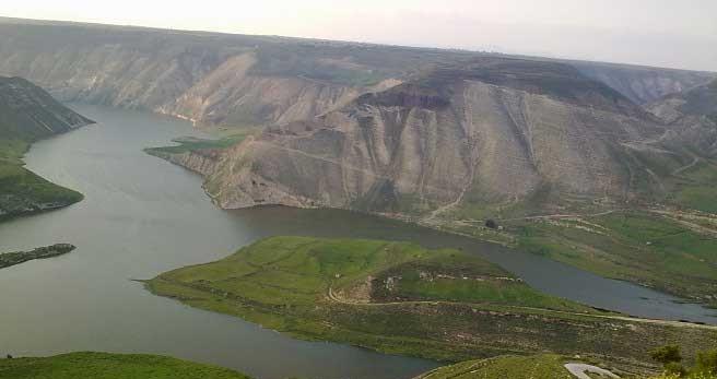

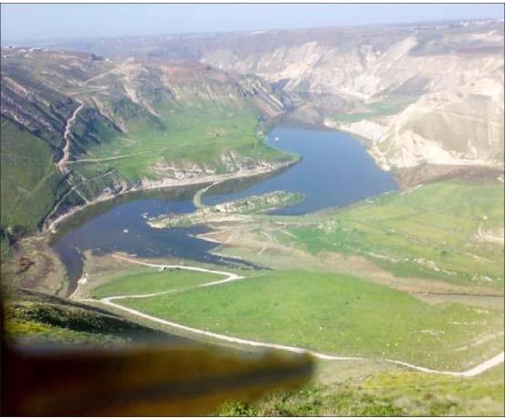


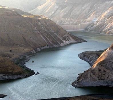
A cross-border water reservoir on the Yarmouk river, formerly known as Maqarin Dam. Its capacity is estimated at 115 million square metres of water.
The Wikipedia link gives interesting information about the former size of the reservoir, the treaty with Syria, and the use its water.
The Wikipedia link gives interesting information about the former size of the reservoir, the treaty with Syria, and the use its water.
Wikipedia article: http://en.wikipedia.org/wiki/Al-Wehda_Dam
Nearby cities:
Coordinates: 32°43'34"N 35°52'44"E
- King Talal dam 59 km
- Al-Bassel Lake 230 km
- Reyhanlı Dam 412 km
- Berke Dam 532 km
- DSİ Kılavuzlu Dam 556 km
- Hadithah Dam 622 km
- shahar chay dam 972 km
- Sarı Mehmet Lake 981 km
- Qarah Zia od Din Dam & Lake 1055 km
- Barun Dam & Lake 1055 km
- Kawm al Hawz farms 4.5 km
- قرية ذنيبه الكبرى 4.9 km
- Muzayrib Subdistrict 11 km
- Battlefield of the Battle of Yarmouk 13 km
- Irbid governorate 20 km
- Daraa Governorate (PCS) 28 km
- Horan Plain 30 km
- Golan Plateau 31 km
- Golan Heights 34 km
- UNDOF Zone 40 km