Woodrow Wilson Bridge
USA /
Virginia /
Huntington /
World
/ USA
/ Virginia
/ Huntington
World / United States / Maryland
drawbridge
Add category
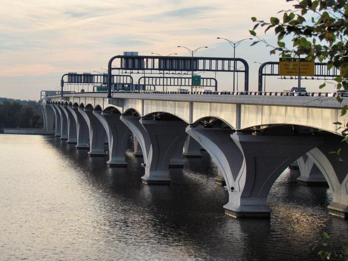
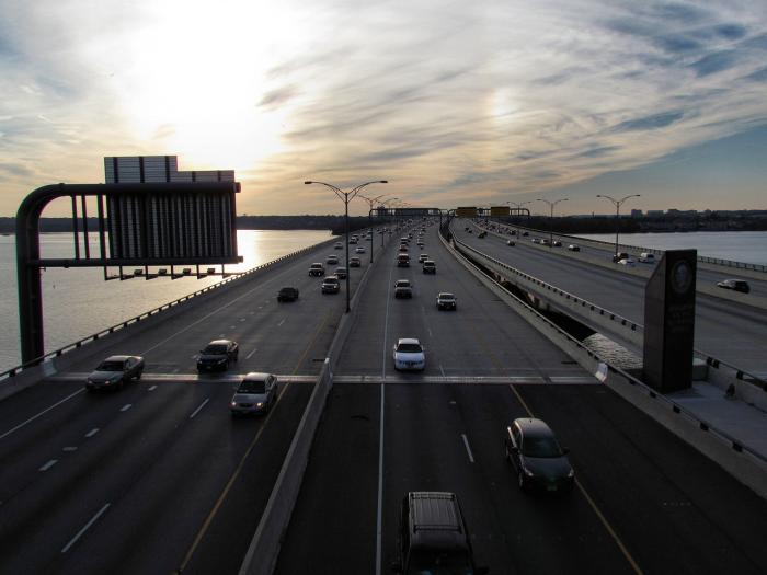
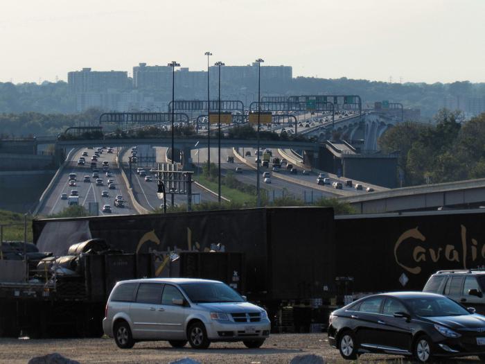
The Woodrow Wilson Memorial Bridge is a bascule bridge spanning the Potomac River between Alexandria, Virginia and Oxon Hill in Prince George's County, Maryland. While over the water near the Virginia shore, it crosses the southern tip of the District of Columbia. The bridge carries Interstate 95 and Interstate 495 (the Capital Beltway).
The bridge was part of an overall project which also included an extensive redesign and reconstruction of the Capital Beltway and four interchanges at Telegraph Road (Virginia Route 241/611), Richmond Highway (US 1), Anacostia Freeway (Interstate 295), and Indian Head Highway (Maryland Route 210). The entire cost of the project was US$2,500,000,000. Construction started on the bridge replacement project in 2000.
The Woodrow Wilson Bridge consists of two side-by-side drawbridges. The first opened for northbound Outer Loop traffic on June 10, 2006. The second opened for southbound Outer Loop traffic on May 15, 2008. Of the 12 lanes, six are used for local traffic, four are used for through traffic, and two are used for HOV lane and bus traffic. The bridge has a total length of 6,736 ft (2,053 m), a clearance of 70 ft, and an overall width of 76 m (250 ft). It was designed to handle 250,000 vehicles per day.
The bridge replaced an earlier bascule bridge of the same name that opened in 1961.
Wikipedia article: http://en.wikipedia.org/wiki/Woodrow_Wilson_Bridge
Nearby cities:
Coordinates: 38°47'34"N 77°2'8"W
- Amtrak BUSH Interlocking & Movable Bridge 99 km
- Delair Bridge 215 km
- DOCK Drawbridge & Interlocking Tower (Closed) 327 km
- LEAD Interlocking, Tower & Movable Bridge 352 km
- DB Lift Bridge and Interlocking 499 km
- NS ROUGE BRIDGE Interlocking and Tower 647 km
- CP-509 "Quad Draws" Bridges 950 km
- NS (Southern) NO&NE Bridge 1514 km
- I-5 Interstate bridge 3786 km
- BNSF 5.1 railroad bridge 3792 km
- Jones Point Park 0.5 km
- Alexandria VA flood zone 1.1 km
- Old Town Alexandria 1.7 km
- Interstate 95/495 Exit 177 1.8 km
- Belle Haven Country Club 2 km
- Wilkes Street cemetery complex 2 km
- Dyke Marsh 2.9 km
- Belle Haven, Virginia 2.9 km
- Huntington, Virginia 3.2 km
- Fort Washington, Maryland 6 km