Takmak Fort
India /
Maharashtra /
Virar /
World
/ India
/ Maharashtra
/ Virar
World / India / Maharashtra / Thane
fortification
Add category
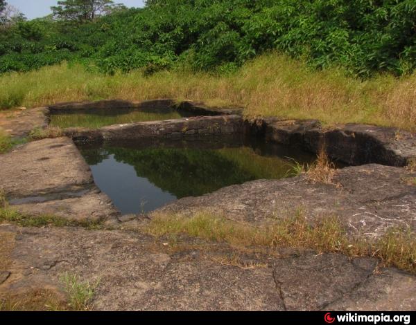
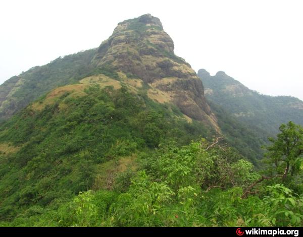
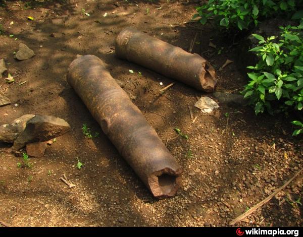
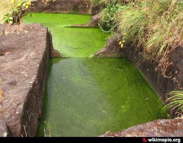
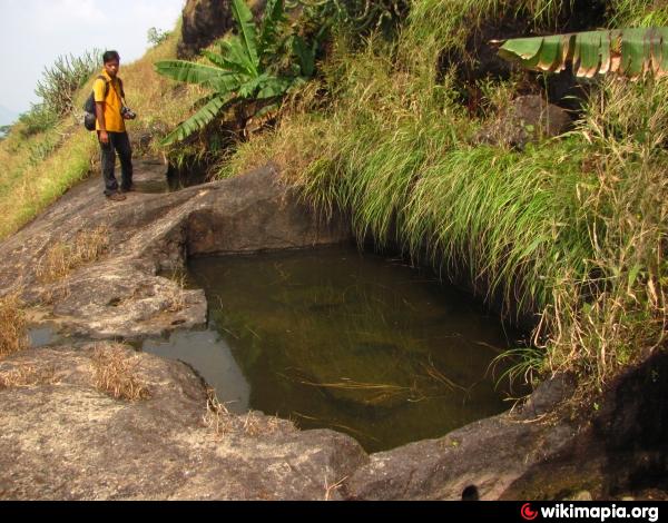
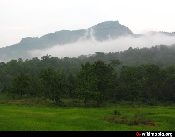
The Takmak fort situated near Sakwar village comprises of a 2 flat tops, which although appear connected are not easy to access from one another. The first 50% of the route is thickly forested and provides a good cover from the blistering Sun. It takes 2 hours 30 mins to reach the top. The top is small with various flat areas connected by thickets. The entire fort (on this side) could be covered in about 30 mins. There are 2 canons atop and also total 12 water tanks. The top provides a commanding view of nearby hills and water bodies.
Photographs: picasaweb.google.com/112424448078863794767/TakmakFort
Photographs: picasaweb.google.com/112424448078863794767/TakmakFort
Nearby cities:
Coordinates: 19°33'52"N 72°56'36"E
- Tandulwadi Fort 13 km
- Kila Pagar 22 km
- Vasai Fort 29 km
- Asherigad 29 km
- Gambhirgad 56 km
- Dronagiri 77 km
- Karnala Fort 77 km
- Avchitgad Fort 122 km
- DANTI PROTECTION WALL 167 km
- Old town 238 km
- Vandri Lake and Dam 5 km
- Vegas Universe 6.2 km
- supreme leisure farms 6.4 km
- sankalp dham Sativali 7.8 km
- Pargaon Lake 7.9 km
- patils 9 km
- VISHWANATH PATIL , ATMARAM PATIL PROPERTY 10 km
- DONGARI PADA 10 km
- Palghar Range 16 km
- Palghar Taluka 21 km