Ouadane
Mauritania /
Adrar /
Singati /
World
/ Mauritania
/ Adrar
/ Singati
, 97 km from center (شنقيطي)
World / Mauritania / Adrar
town, UNESCO World Heritage Site

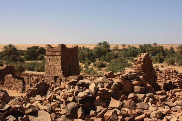
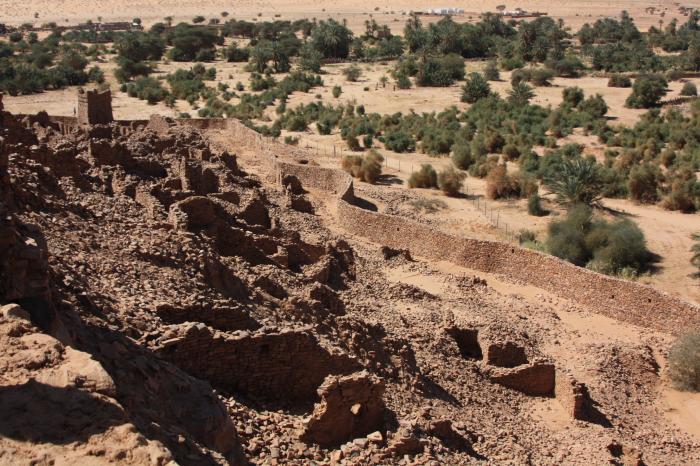
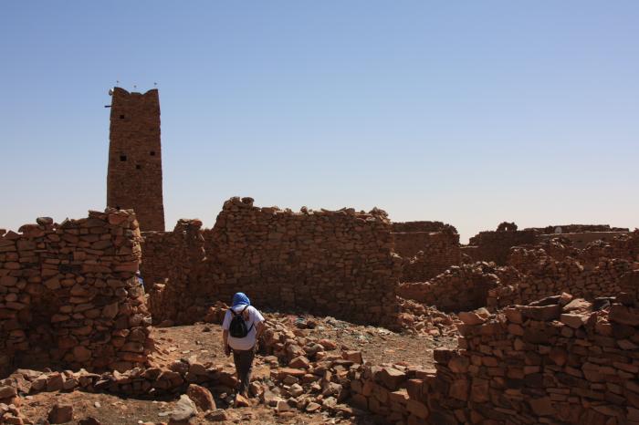
Ouadane or Wadan (Arabic: وادان) is a small town in the desert region of central Mauritania, situated on the southern edge of the Adrar Plateau, 93 km northeast of Chinguetti. The town was a staging post in the trans-Saharan trade and for caravans transporting slabs of salt from the mines at Idjil. A Portuguese trading post was established in 1487, but was probably soon abandoned. The town declined from the sixteenth century and most of the town now lies in ruins.
The old town, a World Heritage Site, though in ruins, is still substantially intact, while a small modern settlement lies outside its gate.
Ouadane is the closest town to the Richat Structure, a massive circular landmark visible from space
The old town, a World Heritage Site, though in ruins, is still substantially intact, while a small modern settlement lies outside its gate.
Ouadane is the closest town to the Richat Structure, a massive circular landmark visible from space
Wikipedia article: http://en.wikipedia.org/wiki/Ouadane
Nearby cities:
Coordinates: 20°56'9"N 11°37'36"W
- Banc d'Arguin National Park 572 km
- Mount Nimba Strict Nature Reserve - UNESCO World Heritage Site 1507 km
- Doñana National Park 1871 km
- Lake District National Park 3823 km
- Vatnajökull 4909 km
- Everglades National Park 7078 km
- Great Smoky Mountains National Park 7124 km
- Parque Nacional Darién 7276 km
- Coiba Island 7668 km
- Sian Ka'an biosphere reserve 7876 km
- Semsiyat dome 23 km
- Uad Bamoure 25 km
- Seheb Tin Jouker 31 km
- Richat Structure 33 km
- Uad Akerdil 37 km
- Sebkha Akerdil 42 km
- Sebkha Touljinit 47 km
- Sebkhat chemchame 54 km
- Aderg 63 km
- Sebket Bou Talha 131 km