Parque Nacional Darién
Panama /
Embera /
Capeti /
World
/ Panama
/ Embera
/ Capeti
forest, birdwatching area, nature conservation park / area, UNESCO World Heritage Site

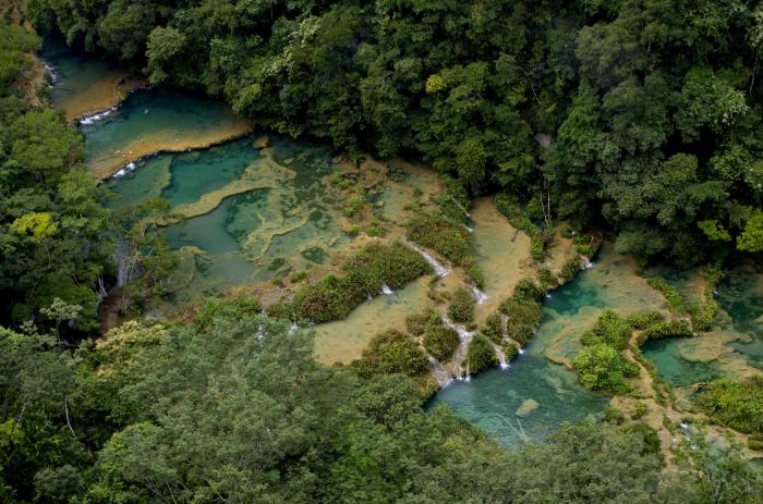


A National Park in far eastern Panama covering the border to Colombia. Covering over 500,000 Hectares (1.2 million acres) it is a UNESCO World Heritage Site conserving a vast area of largely untouched tropical wilderness, which uniquely joins two continents.
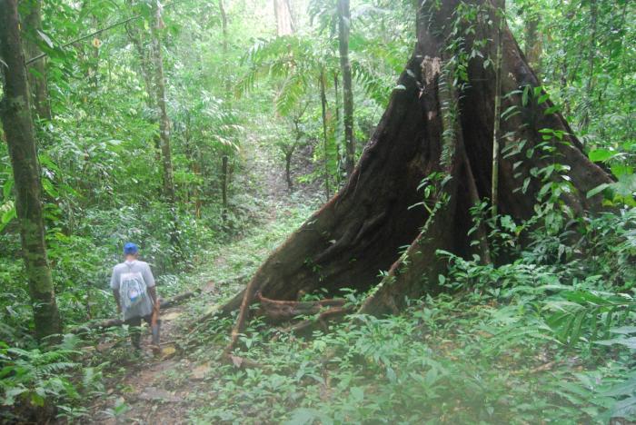
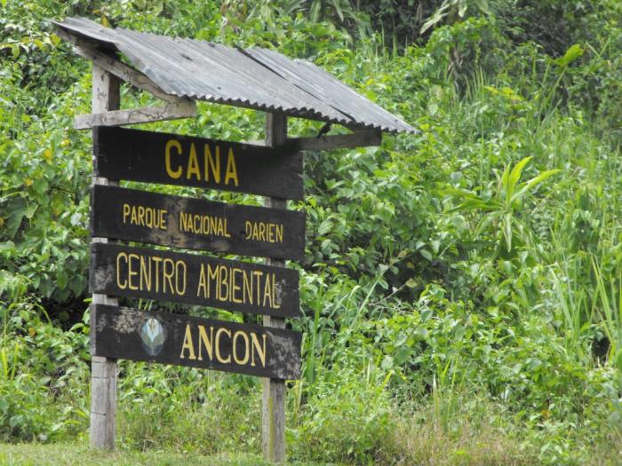
There are very few possible ways to visit the National Park, mainly due to its remoteness and sporadic activity from Colombian rebels. The best site is Cana in the Serranía de Pirre as part of an organised tour.
It also covers the area known as the "Darién Gap", the gap in the Pan American Highway. There have been many plans to complete the road, but the unique terrain has thus far proven impassable, and it appears it will be so for the foreseeable future.
whc.unesco.org/en/list/159
Wikipedia article: http://en.wikipedia.org/wiki/Darién_National_Park
Nearby cities:
Coordinates: 7°52'38"N 77°47'32"W
- Serranía de Pirre 18 km
- Parque Nacional Los Katios 50 km
- Chingaza National Natural Park 553 km
- Médanos de Coro National Park 966 km
- Columbia River Forest Reserve 1568 km
- Chiquibul National Park 1599 km
- Banco Chinchorro Biosphere Reserve 1600 km
- Belize Maya Forest 1647 km
- Rio Bravo Conservation and Management Area 1660 km
- Sian Ka'an biosphere reserve 1752 km
- Pinas Bay 56 km
- Cerro Tacarcuna (1,874m) 65 km
- San Miguel Bay 76 km
- Golfo De Uraba, Colombia 107 km
- Punta Marzo, Colombia 115 km
- Nueva Colonia 119 km
- Pearl Island Archipelago 142 km
- Bahia de Cupica 154 km
- Gulf of Panama 179 km
- Ensenada de Utria 212 km
Comments