HAARP (IRI) Ionospheric Research Instrument
USA /
Alaska /
Gakona /
World
/ USA
/ Alaska
/ Gakona
World / United States / Alaska
military, antenna, weather / meteorological station
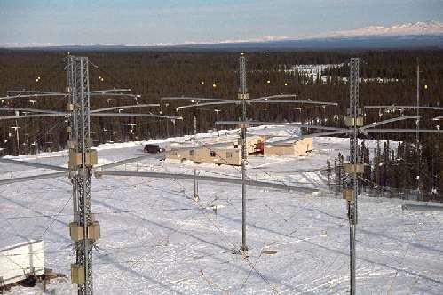
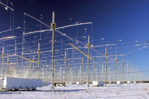
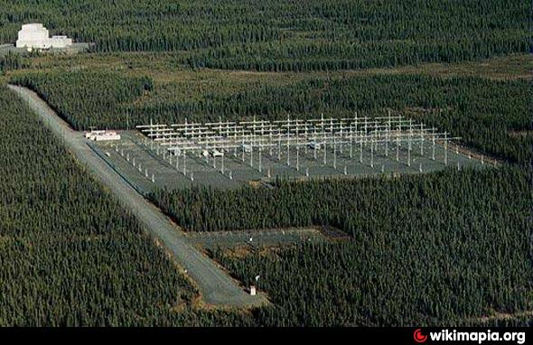

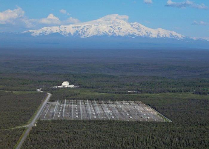
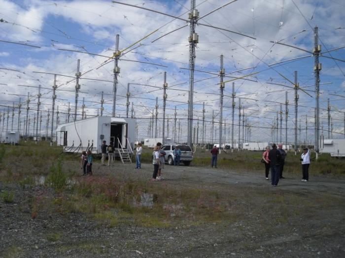
Estimated current ERP 5.1 GW - 2.8-10 MHz Basically, the IRI is what is known as a phased array transmitter. It is designed to transmit a narrow beam of high power radio signals in the 2.8 to 10 MHz frequency range. Its antenna is built on a gravel pad having dimensions of 1000' x 1200' (about 33 acres). There are 180 towers, 72' in height mounted on thermopiles spaced 80' apart in a 12 x 15 rectangular grid. Each tower supports near its top, two pairs of crossed dipole antennas, one for the low band (2.8 to 8.3 MHz), the other for the high band (7 to 10 MHz). The antenna system is surrounded by an exclusion fence to prevent possible damage to the antenna towers or harm to large animals. An elevated ground screen, attached to the towers at the 15' level, acts as a reflector for the antenna array while allowing vehicular access underneath to 30 environmentally-controlled transmitter shelters spaced throughout the array. Each shelter contains 6 pairs of 10 kW transmitters, for a total of 6 x 30 x 2 x 10 kW = 3600 kW available for transmission. The transmitters can be switched to drive either the low or high band antennas. Electric prime power is provided from an on-site power plant housing five, 2500 kW generators, each driven by a 3600 hp diesel engine. Four generators are required for operation of the IRI and the fifth is held as a spare. From a control room within the Operations Center, the transmission from each of the 180 crossed-dipole antennas is adjusted in a precise manner under computer control. In this manner, the complete array of antennas forms a narrow antenna pattern pointed upward toward the ionosphere. The transmitted signal diverges (spreads out) as it travels upward and is partially absorbed, at an altitude which depends on the transmitted HF frequency, in a small volume several tens of miles in diameter and a few hundred meters thick directly over the facility. The remainder of the transmitted signal either reflects back toward the earth or passes through the ionosphere into space, continuing to diverge as it does so. By the time it reaches the ionosphere, the intensity of the HF signal is less than 3 microwatts (0.000003 watt) per cm2, thousands of times less than the Sun's natural electromagnetic radiation reaching the earth and hundreds of times less, even, than the variations in intensity of the Sun's natural ultraviolet (UV) energy which creates the ionosphere.
Nearby cities:
Coordinates: 62°23'32"N 145°9'2"W
- Gerstle River Arctic Test Site 161 km
- Fort Greely Missile Defense Command Base 184 km
- Donnelly Training Area, AK 189 km
- Blair Lake Air Force Range, AK 262 km
- Fort Richardson Army Base 270 km
- Fort Richardson 271 km
- Elmendorf Air Force Base (EDF/PAED) 276 km
- Eielson Air Force Base, AK (EIL/PAEI) 281 km
- Clear Air Force Station 297 km
- Fort Wainwright 304 km
- Mount Drum (12,010ft) 41 km
- Tazlina Lake 87 km
- Klutina Lake 88 km
- Nabesna Glacier 112 km
- Kennicott Glacier 142 km
- Tetlin Lake 145 km
- Root Glacier 148 km
- Delta Bison Range Panoramic Fields 167 km
- Fort Greely, AK 176 km
- Carden Hills 205 km