The Great Falls
USA /
Montana /
Black Eagle /
World
/ USA
/ Montana
/ Black Eagle
World / United States / Montana
waterfall
Add category

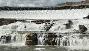
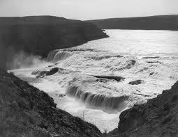

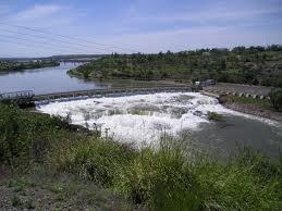

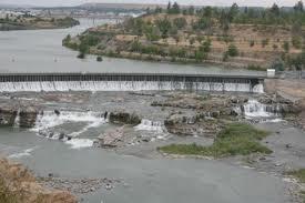
the fifth, and largest falls, in a ten mile stretch of the Missouri River in the Great Falls, MT. area. This falls is now mostly covered up by the Ryan Dam facility. Hopwever, the remaining portion is still of a significant size/height.
Wikipedia article: http://en.wikipedia.org/wiki/Great_Falls_(Missouri_River)
Nearby cities:
Coordinates: 47°34'6"N 111°7'24"W
- Dry Falls State Park 622 km
- Oregon Jack Provincial Park 830 km
- Lewis River Waterfalls 833 km
- Widgeon Creek Nature Reserve 879 km
- Nairn Falls Park 909 km
- Princess Louisa Inlet 976 km
- Stamp River Provincial Park 1038 km
- Beaver Falls, MN and County Park (Renville County) 1281 km
- Mound Creek County Park (Brown County) 1297 km
- Nerstrand Woods State Park 1435 km
- Malmstrom Air Force Base (GFA/KGFA) 8.4 km
- Emerson Junction, Montana 22 km
- Sun Prarie, Montana 28 km
- Juliet Flight 30 km
- Vaughn, Montana 33 km
- India Flight 37 km
- Sun River, Montana 45 km
- Power, Montana 46 km
- Fort Shaw, Montana 53 km
- Hotel Flight 58 km