Two Mile Bend (Gloucester)
United Kingdom /
England /
Gloucester
World
/ United Kingdom
/ England
/ Gloucester
World / United Kingdom / England
moveable bridge
Add category
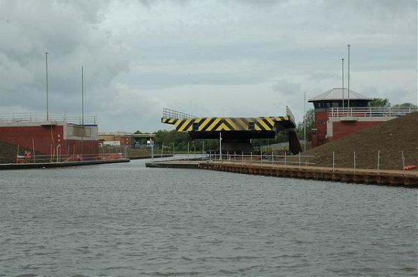


This "Z" bend in the canal was always difficult for larger vessels to negotiate. Many vessels had to put lines ashore to swing them around the tight corners.
In 2006, a new bypass road was constructed with a swing bridge for large vessels across a new "cut" which reduced the severity of the bend.
There is a certain irony in the fact that funds to remove this obstacle were made available many years after large commercial traffic had all but ceased on the canal!
Nearby cities:
Coordinates: 51°50'19"N 2°16'22"W
- Sarah Mildred Long Bridge (2018) 5050 km
- NJT HX Interlocking & Drawbridge 5424 km
- Amtrak PORTAL Interlocking and Drawbridge 5427 km
- UPPER BAY Interlocking & Lift Bridge 5433 km
- RIVER Movable Bridge 5457 km
- Burlington-Bristol Bridge 5525 km
- Tacony-Palmyra Bridge 5541 km
- Woodrow Wilson Bridge 5761 km
- Pelican Island Causeway (Herbert E. Schmidt Causeway) 7663 km
- Rio Vista Bridge (Helen Madere Memorial Bridge) 8425 km
- Gloucester Sewage Treatment Works 0.4 km
- Jack Morgan Farm 2.6 km
- Robinswood Hill 2.8 km
- Tredworth Road Cemetery 3.1 km
- Coney Hill Cemetery 4.1 km
- Gloucester Railway Triangle 4.1 km
- Walls Ice Cream Factory 5.8 km
- Sir Thomas Rich's school grounds 5.9 km
- Imjin Barracks Military Housing Area 7.4 km
- Former RAF Innsworth / Imjin Barracks 7.9 km