Hawes Auxillary Army Air Field No.1
USA /
California /
Lenwood /
World
/ USA
/ California
/ Lenwood
World / United States / California
closed / former military
Add category
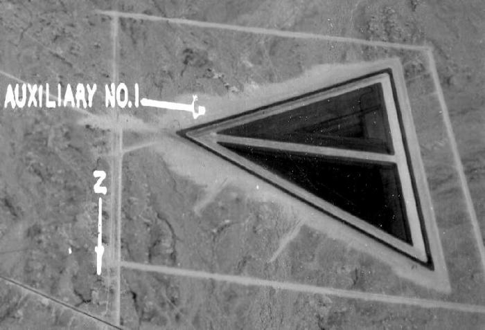
This site was one of 4 Auxillary Air Fields (AAF) for the Victorville Army Air Field (later renamed George AFB). The Other three were Helendale, El Mirage and Grey Buttes. Site later used as a radio relay station and the outer marker for George AFB.
Hawes Auxillary Air Field participated in the 30,000 Pilot Training Program & later became a bombardier school.
The date of construction of Hawes is unknown.
The earliest reference to the field which has been located is the 1944 LA Sectional Chart.
The 1944 US Army/Navy Directory of Airfields described "Hawes Aux. #1, Army" as having a 5,600' hard-surface runway, and the remarks included, "Auxiliary to Victorville AAF."
Nearby cities:
Coordinates: 34°55'22"N 117°22'28"W
- Former Marine Corps Air Station El Toro 141 km
- Fort Ord (site) 448 km
- Concord Naval Weapons Station 541 km
- Former Mare Island Naval Shipyard 566 km
- Kansas Army Ammunition Plant (Closed) 2006 km
- Sunflower Army Ammunition Plant (Closed) 2032 km
- Red River Redevelopment Authority 2125 km
- Longhorn Army Ammunition Plant Site (CLOSED) 2155 km
- Camp Claiborne WWII Army Camp 2345 km
- Camp Livingston ( US Army Historic) 2353 km
- Mojave Solar Project 11 km
- Harper Dry Lake 15 km
- Hinkley, California 17 km
- Cuddeback Air to Ground Gunnery Range 41 km
- Grass Valley Wilderness Area 42 km
- Coyote Lake 60 km
- Goldstone Deep Space Communications Tracking Station 66 km
- Naval Air Weapons Station China Lake, South Range 70 km
- Desert Warfare Training area 83 km
- Fort Irwin National Training Center 85 km
Mojave Solar Project
Harper Dry Lake
Hinkley, California
Cuddeback Air to Ground Gunnery Range
Grass Valley Wilderness Area
Coyote Lake
Goldstone Deep Space Communications Tracking Station
Naval Air Weapons Station China Lake, South Range
Desert Warfare Training area
Fort Irwin National Training Center
Comments