Shields' Mill Covered Bridge
USA /
Indiana /
Brownstown /
World
/ USA
/ Indiana
/ Brownstown
World / United States / Indiana
NRHP - National Register of Historic Places, covered bridge, 1876_construction
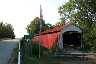
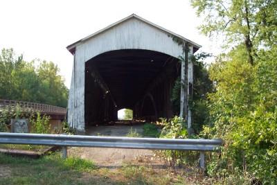
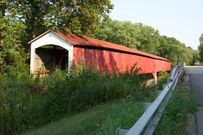
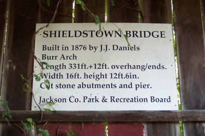
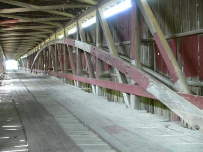
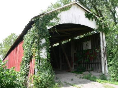
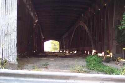
Shields' Mill Covered Bridge, also known as Shieldstown Covered Bridge, is a historic covered bridge located in Brownstown Township and Hamilton Township, Jackson County, Indiana. It spans the White River and is a multiple kingpost Burr Arch Truss bridge. It was built 1876, and is a two-span wooden bridge resting on cut limestone pier and abutments. It measures 365 feet, 6 inches, long. The bridge was closed to traffic in 1970.
It was listed on the National Register of Historic Places in 2016.
It was listed on the National Register of Historic Places in 2016.
Wikipedia article: https://en.wikipedia.org/wiki/Shields'_Mill_Covered_Bridge
Nearby cities:
Coordinates: 38°54'54"N 86°0'9"W
- Bell Ford Bridge 9 km
- Restored Covered Bridge & Park 99 km
- Shadyside Recreation Area 139 km
- Bollinger Mill State Historic Site 375 km
- Clearbranch Methodist Baptist Church and Covered Bridge 583 km
- Abandoned Bridge Piers 710 km
- Pennsylvania Railroad Bridge (Ruins/Demolished) 823 km
- Conowingo Bridge (Former Site) 848 km
- Port Deposit Bridge remnants 853 km
- Covered Bridge Park 1504 km
- Jackson County, Indiana 5.1 km
- Freeman Municipal Airport (SER/KSER) - Freeman Field 8.4 km
- Springhill Camp: Indiana 10 km
- THE COFFIN, BOBTOWN, IN 13 km
- Muscatatuck National Wildlife Refuge 17 km
- Hoosier National Forest 26 km
- Bartholomew County, Indiana 33 km
- Jennings County, Indiana 34 km
- Scott County, Indiana 34 km
- Brown County, Indiana 37 km