Bell Ford Bridge (original site)
USA /
Indiana /
Seymour /
World
/ USA
/ Indiana
/ Seymour
World / United States / Indiana
destroyed, covered bridge, 1860s construction, historical layer / disappeared object


The bridge was originally built in 1869. Built in two sections, the wood and iron bridge measured 325 feet long. The western span collapsed in February 1999 during a windstorm.
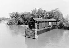
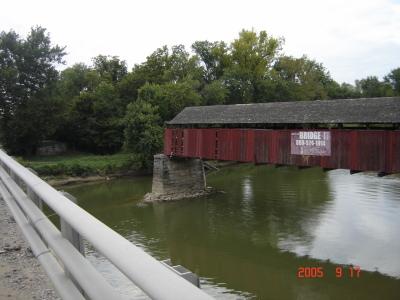
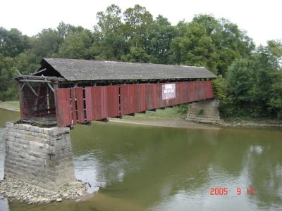
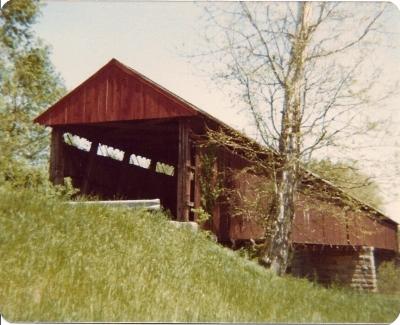
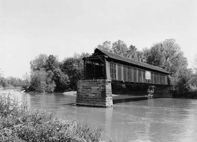
The Bell Ford Post Patented Diagonal "Combination Bridge", often simply called the Bell Ford Bridge or Bell Ford Covered Bridge, was a covered bridge originally located in Jackson County, Indiana, northwest of Seymour, Indiana. The bridge spanned the East Fork of the White River on a former alignment of State Road 258, and was placed on the National Register of Historic Places on March 25, 2005.
The bridge's western span collapsed in February 1999 during a windstorm, and the eastern span collapsed on January 2, 2006, nine months after it made the National Register. The remains of the bridge were stored until funding and a new site were identified in Hamilton County, Indiana. The reconstructed bridge was relocated in 2024 and dedicated in June 2025 near Fishers, Indiana.
Wikipedia article: http://en.wikipedia.org/wiki/Bell_Ford_Bridge
Nearby cities:
Coordinates: 38°58'24"N 85°55'46"W
- Restored Covered Bridge & Park 91 km
- Shadyside Recreation Area 131 km
- Roann Covered Bridge 216 km
- Bollinger Mill State Historic Site 383 km
- Clearbranch Methodist Baptist Church and Covered Bridge 590 km
- Abandoned Bridge Piers 703 km
- Pennsylvania Railroad Bridge (Ruins/Demolished) 816 km
- Conowingo Bridge (Former Site) 840 km
- Port Deposit Bridge remnants 846 km
- Covered Bridge Park 1507 km
- Freeman Municipal Airport (SER/KSER) - Freeman Field 5.6 km
- THE COFFIN, BOBTOWN, IN 7.1 km
- Muscatatuck National Wildlife Refuge 12 km
- Jackson County, Indiana 14 km
- Springhill Camp: Indiana 14 km
- Bartholomew County, Indiana 25 km
- Jennings County, Indiana 27 km
- Hoosier National Forest 30 km
- Brown County, Indiana 36 km
- Scott County, Indiana 36 km