Lower Holloway (London)
United Kingdom /
England /
London
World
/ United Kingdom
/ England
/ London
World / United Kingdom / England
district, draw only border
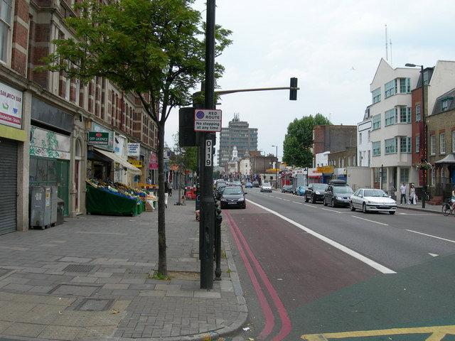


A build up area of west Islington, consisting of large housing estates, the Holloway Road, Arts Museums and a big market area.
Wikipedia article: http://en.wikipedia.org/wiki/Lower_Holloway
Nearby cities:
Coordinates: 51°33'13"N -0°7'10"E
- Beckenham 15 km
- Wycombe District 63 km
- Redditch 154 km
- Hall Green 160 km
- Selly Oak 161 km
- Northfield 164 km
- Edgbaston 166 km
- Halesowen 171 km
- Pontypridd 226 km
- North Devon 290 km
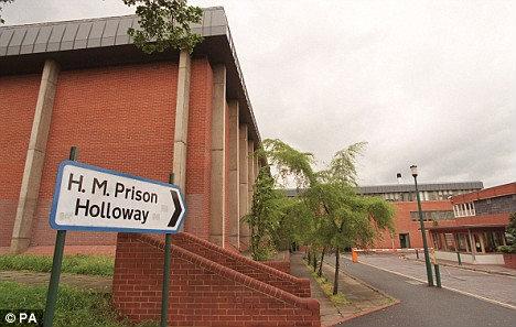
- HMP Holloway 0.4 km
- Hyde Village / Surco Estate 0.5 km
- Ringcross Estate 0.6 km
- Harvist Estate 0.7 km
- London Borough of Islington 1 km
- Whittington Park 1.1 km
- The Andover Estate 1.1 km
- Bush Industrial Estate 1.2 km
- Camden Council 3 km
- London Borough of Barnet 9 km
Comments