Ward's Island
USA /
New Jersey /
West New York /
World
/ USA
/ New Jersey
/ West New York
World / United States / New York
island
Add category
Long ago called Tenkenas (Dutch: "Wild Land")and then Buchanan's Island, Great Barn Island, and/or Barendt's Island. After the Revolutionary War, it was renamed after new owners Bartholomew Ward and Jaspar Ward who commissioned construction of a drawbridge and started some enterprises on the land.
After a storm wrecked the bridge, the island fell into disrepair and eventually reverted to wild land. Next, the City began using the area as a dumping ground ---both of unwanted refuse and of unwanted people (living and dead). The insane, the sick, and the destitute were put here. Unclaimed corpses from old Manhattan cemeteries being redeveloped were reburied here. In the mid 19th Century, immigrants were processed here (until the Ellis Island facility was completed). The institution which became the Manhattan Psychiatric Center was here ---with over 6,000 mentally-disturbed patients resident circa 1920.
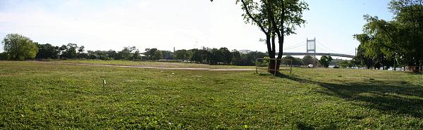
Circa 1935-45, the island was re-sculpted and "de-islandized" under authority of the visionary NYC Parks Commissioner, Robert Moses. The Little Hell Gate waterway was filled in, thus connecting Ward's Island to nearby Randall's Island. A massive water-treatment facility was constructed. Much of the remaining land was meant to become public parkland and ball fields. The Ward Island Bridge, an elevated walkway whose central segment can be raised for ship-passage, connected Ward Island to East Harlem which had long been without much access to parks and greenspace.
In the 2000's, the parks were undergoing renovation.
After a storm wrecked the bridge, the island fell into disrepair and eventually reverted to wild land. Next, the City began using the area as a dumping ground ---both of unwanted refuse and of unwanted people (living and dead). The insane, the sick, and the destitute were put here. Unclaimed corpses from old Manhattan cemeteries being redeveloped were reburied here. In the mid 19th Century, immigrants were processed here (until the Ellis Island facility was completed). The institution which became the Manhattan Psychiatric Center was here ---with over 6,000 mentally-disturbed patients resident circa 1920.
Circa 1935-45, the island was re-sculpted and "de-islandized" under authority of the visionary NYC Parks Commissioner, Robert Moses. The Little Hell Gate waterway was filled in, thus connecting Ward's Island to nearby Randall's Island. A massive water-treatment facility was constructed. Much of the remaining land was meant to become public parkland and ball fields. The Ward Island Bridge, an elevated walkway whose central segment can be raised for ship-passage, connected Ward Island to East Harlem which had long been without much access to parks and greenspace.
In the 2000's, the parks were undergoing renovation.
Wikipedia article: http://en.wikipedia.org/wiki/Ward's_Island
Nearby cities:
Coordinates: 40°47'10"N 73°55'37"W
- Long Beach Island 118 km
- Wye Island 285 km
- Kent Island 285 km
- Middle Hooper's Island 339 km
- Bloodsworth Island 342 km
- South Marsh Island 347 km
- Smith Island, MD/VA 356 km
- Hog Island 401 km
- Cobb Island 414 km
- Smith Island, Virginia 437 km
- Hell Gate 0.1 km
- East (Spanish) Harlem 1.7 km
- Ditmars-Steinway 1.7 km
- Astoria 1.9 km
- Mott Haven 2.6 km
- Harlem (Manhattan, NY) 2.9 km
- Manhattan 3.7 km
- Western Queens 6 km
- The Bronx 10 km
- Queens 16 km