Kamika Cliff
Bulgaria /
Sofijska oblast /
Svoge /
World
/ Bulgaria
/ Sofijska oblast
/ Svoge
, 7 km from center (Своге)
World / Bulgaria / Sofia
cliff
Add category

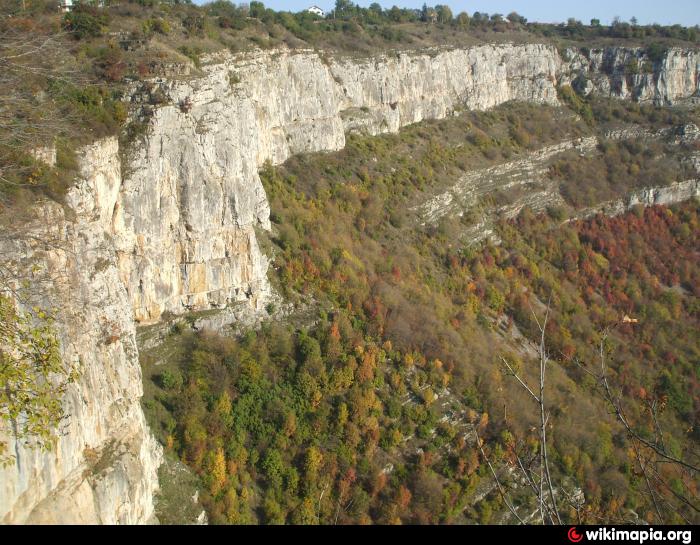
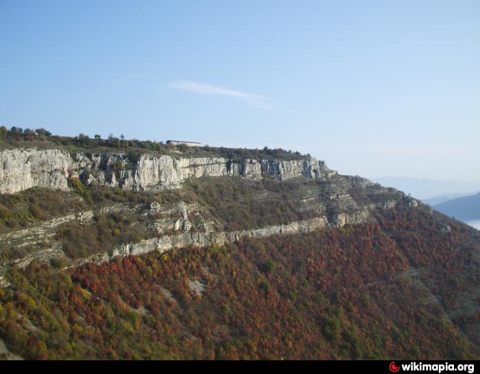
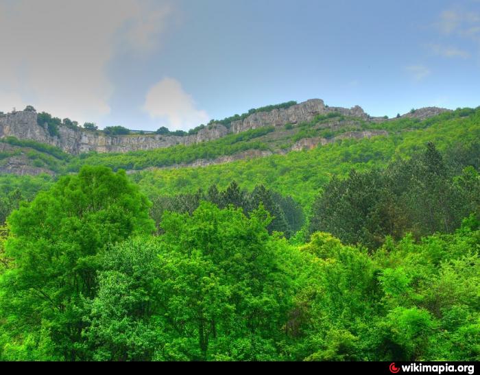
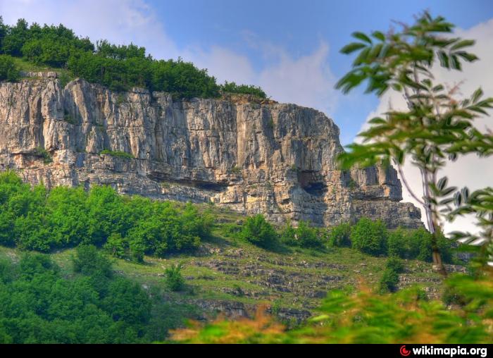
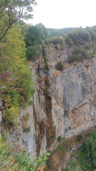
The rock crown Kamika (Skaklya) near the village of Zasele is part of the discoveries of the Triassic limestones and dolomites, forming the Lakatnishki rocks in the Iskar Gorge. It is formed on the western slope of the valley of the river Iskar, immediately east of the village of Zasele (43.03674, 23.33048). The rock crown is a dizzying karst precipice in which the Skaklya waterfall is formed. The area is part of the Ponor protected area in 2008, located between the Serbian border and the Iskar River, which is part of the NATURA 2000 ecological network. called "Vazova eco-trail", for which there are signs on the road Sofia-Mezdra near the village of Tserovo and Bov Station. The base of the rock crown is at an altitude of 750 m, and its upper edge of the ridge near the village of Zasele is 900 m. It is described for the first time as a geological phenomenon within the present project.
www.flickr.com/photos/bohis/4505985164
www.flickr.com/photos/bohis/4505985164
Nearby cities:
Coordinates: 43°2'13"N 23°20'4"E
- Kobilini Steni Cliff 14 km
- Megalithic Complex of Caves, Trapezoidal Niches and Rock Paintings 200 km
- Nikola's Cliffs 407 km
- Klify 1346 km
- Møns Klint 1545 km
- Stevns Klint 1580 km
- The White Cliffs of Dover 1885 km
- Seven Sisters 1950 km
- Seven Sisters Country Park 1951 km
- Kjerag 2120 km
- Pedestrian bridge 0.1 km
- Ivan Vazov's rock 0.2 km
- Bower 0.2 km
- Panoramic View 0.4 km
- Skaklya Waterfall 0.4 km
- Peak Bula 2.1 km
- Biloto Peak - 1,142.5 m 2.2 km
- Kayshov Vruh - 1,413.2 m 3.1 km
- Ponor Mountain 10 km
- Iskar Gorge 16 km