Monument to the Three Charters for National Reunification (Pyongyang)
Korea (North) /
Pyongyang /
Pyongyang /
Pyongyang-Kaesong Motorway
World
/ Korea (North)
/ Pyongyang
/ Pyongyang
World / North Korea / P'yŏngyang
historical layer / disappeared object
Add category

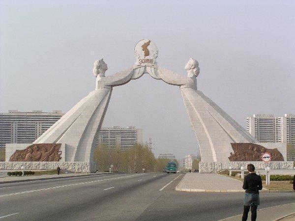
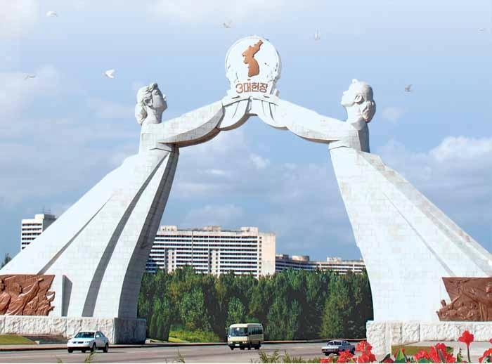
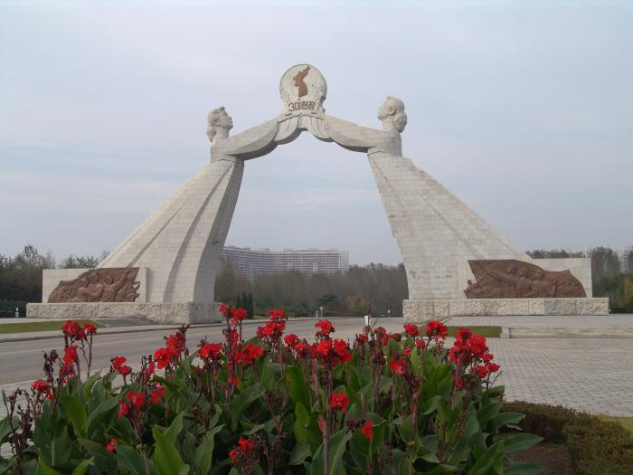
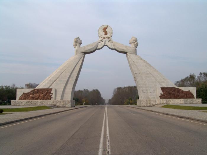
Erected in 2001 this monument watches over the Tongil Expressway to Panmunjom--the symbolic border between the DPRK and ROK. It measures 30 m (around 110 ft) in height and 61.5 m (225 ft) wide and it depicts two women in traditional Korean garments holding a map of Korea. There are scores small reliefs and statues throughout the monument, as well as a museum.
Wikipedia article: http://en.wikipedia.org/wiki/Arch_of_Reunification
Nearby cities:
Coordinates: 38°57'51"N 125°42'56"E
- Old walled city of Pyongyang 8.6 km
- Chollima 15 km
- Yonggung-dong No. 2 18 km
- Yonggung 1-dong 19 km
- Kangso 20 km
- Battle of Chemulpo Bay 185 km
- Battle of Heartbreak Ridge 212 km
- Kyo-Hwa-So No.77 Danchun,S. Hamgyong Prison Camp 341 km
- Battle of Tsushima 629 km
- Ancient Dazaifu 743 km
- Kwanmun-dong 1.5 km
- Nakrang-guyok 3.3 km
- Turu-do 4 km
- Tudan-do 4 km
- Ryusong-dong 4.1 km
- Chongpyong-dong 4.5 km
- Phyongchon-guyok 4.7 km
- Chung-guyok 7.1 km
- Mangyongdae-guyok 8.7 km
- Ryŏkpho-guyŏk (Ryŏkpho District) 11 km