Wreck of Diamond Shoal Lightship No. 71
USA /
North Carolina /
Ocracoke /
World
/ USA
/ North Carolina
/ Ocracoke
World / United States / North Carolina
fishing area, scuba diving facility / area, lighthouse, ship, shipwreck, service - Do not use
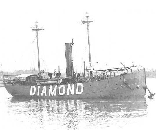
Built in 1897 for the US Lighthouse Service as the LV-71, this lightship served in the waters of the Mid-Atlantic Coast as a floating lighthouse and aid-to-navigation for over 20 years. The majority of her service life was spent marking the treacherous waters off Diamond Shoals, where she found herself stationed on the night of August 6th, 1918.
With the US at war with Germany and her allies in WWI, the waters off the Carolina's were infested with U-Boats attacking allied merchant shipping. LV-71 maintained her vulnerable station during the war and was required to unarmed, such was the importance of her role guiding ships past the shoals. After a nearby merchant ship was torpedoed in the early evening of August 6th, the LV-71 rescued the survivors and transmitted a radio warning to other ships in the area. This message was picked up by the radio operator aboard the U-104, which promptly sped for the LV-71.
After allowing the crew of the Lightship to abandon their ship onto lifeboats, the U-104 sank the LV-71 with surface gunfire at this location on August 6th, 1918.
uscg.mil/history/weblightships/LV71.asp
Nearby cities:
Coordinates: 35°4'48"N 75°19'58"W
- French Creek State Park 577 km
- Seminole Ranch Conservation Area 890 km
- Caesar Creek State Park 925 km
- The Marls 956 km
- Lake Jackson 982 km
- J.E. Roush Fish and Wildlife Area 1097 km
- Cay Sal Bank 1313 km
- Banner Marsh State Fish & Wildlife Area 1416 km
- Lago de Guija 2717 km
- Unare Lagoon 2954 km
- Diamond Shoals 14 km
- Buxton, North Carolina 27 km
- Hatteras Island 30 km
- Hatteras Township 32 km
- Frisco, North Carolina 32 km
- Ocracoke Island, North Carolina 51 km
- Kinnakeet Township 51 km
- Cape Hatteras National Seashore 56 km
- Dare County, North Carolina 79 km
- Hyde County, North Carolina 85 km