Mount Ararat or Masis
| volcano, summit
Turkey /
Agri /
Dogubeyazit /
World
/ Turkey
/ Agri
/ Dogubeyazit
World / Turkey / Iğdır
volcano, summit

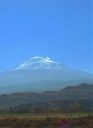

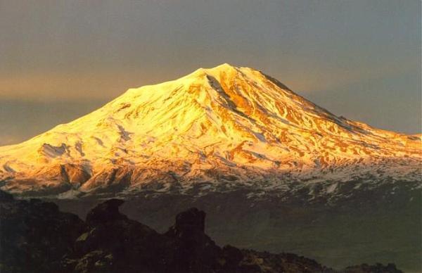
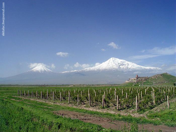

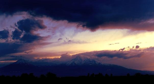
Mount Ararat (Turkish: Ağrı Dağı, Armenian: Մասիս or Արարատ, Kurdish: Çîyaye Agirî, Persian: آرارات) is the tallest peak (5,137 m or 16,854 ft) of Turkey. This snow-capped, dormant volcanic cone is located near the east border of Turkey, 16 km west of the Iranian and 32 km south of the Armenian border.
Technically, Ararat is a stratovolcano, formed of lava flows and pyroclastic ejecta. A smaller (3,896 m) cone, "Little Ararat", rises from the same base, southeast of the main peak. The lava plateau stretches out between the two pinnacles. The last activity on the mountain was a major earthquake in July 1840 centered around the Ahora Gorge, a northeast trending chasm that drops 1,825 metres (6,000 ft) from the top of the mountain.
Technically, Ararat is a stratovolcano, formed of lava flows and pyroclastic ejecta. A smaller (3,896 m) cone, "Little Ararat", rises from the same base, southeast of the main peak. The lava plateau stretches out between the two pinnacles. The last activity on the mountain was a major earthquake in July 1840 centered around the Ahora Gorge, a northeast trending chasm that drops 1,825 metres (6,000 ft) from the top of the mountain.
Wikipedia article: http://en.wikipedia.org/wiki/Mount_Ararat
Nearby cities:
Coordinates: 39°42'22"N 44°17'52"E
- Ariya Volcanic Field 17 km
- Siyahgan Volcanic Field 36 km
- Tendürek Mountain 57 km
- Süphan Mountain 155 km
- Nemrut volcanic massif 218 km
- Karadağ 1010 km
- Salma caldera 1400 km
- Perimeter of Thera before Minoan eruption 1697 km
- Old Activist Volcano Area 1842 km
- Volcano Region Uweinat - North 2663 km
- Mount Ararat 0.6 km
- Ararat valley 27 km
- Ariya Volcanic Field 29 km
- Dil Plain 29 km
- Iğdır Province 29 km
- East Iğdır Plain 30 km
- Doğubayazıt District 31 km
- Artashat district of Ararat province 47 km
- Vedi district of Ararat province 57 km
- Ağrı Province 82 km
Comments