Dunstall Water Bridge (Wolverhampton)
United Kingdom /
England /
Wolverhampton /
Staffordshire and Worcestershire Canal Towpath
World
/ United Kingdom
/ England
/ Wolverhampton
aqueduct, bridge
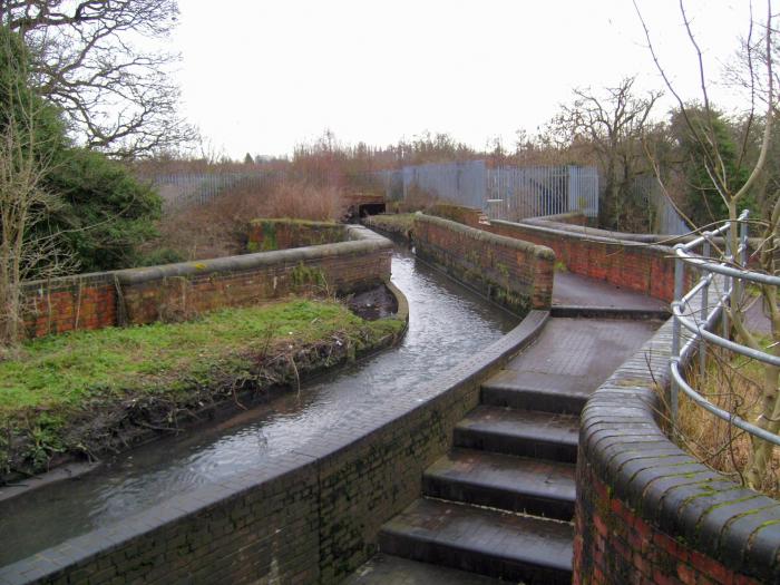
Small aqueduct carrying the River Smestow over the Staffordshire and Worcestershire Canal, c.1770.
Photo: commons.wikimedia.org/wiki/File:Smestow_Brook_06_Dunsta...
Photo: commons.wikimedia.org/wiki/File:Smestow_Brook_06_Dunsta...
Wikipedia article: https://en.wikipedia.org/wiki/Smestow_Brook#Course
Nearby cities:
Coordinates: 52°36'11"N 2°9'4"W
- Aqueduct of Segovia 1306 km
- Ancient Aqueduct 1576 km
- Águas Livres Aqueduct ("Aqueduct of Free Waters") 1636 km
- Canal de l'Aqueduc 5058 km
- Crescent Aqueduct. (Old Erie Canal) 5243 km
- Former Rexford Aqueduct 5251 km
- Schoharie Crossing State Historic Site 5270 km
- Shaft 6, Delaware Aqueduct 5345 km
- Mud Creek Aqueduct 5450 km
- Aqueduct 7401 km
- South Staffordshire 0.3 km
- Dunstall Park 0.5 km
- Smestow Valley Local Nature Reserve 1.5 km
- Bilbrook CP 3.2 km
- Jaguar Engine Plant 3.4 km
- Codsall CP 4.6 km
- Perton CP 5 km
- Featherstone CP 5.8 km
- Brewood and Coven CP 6.8 km
- Saredon CP 8.3 km