Roman Road (Tall al-Karamah)
Syria /
Idlib /
ad-Dana /
Tall al-Karamah
World
/ Syria
/ Idlib
/ ad-Dana
, 3 km from center (الدانا)
World / Syria / Idlib
road, Roman Empire, historical building
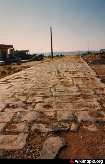
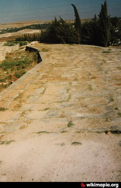
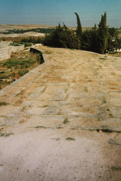
A 900 meters long section of a Roman road that connected Antioch with Beroia/Aleppo survived the centuries. Built most probably under Emperor Marc Aurel (161-180 AC), it was used by Emperor Julian in spring 363 AC on his march to the Euphrates to fight the Sassanides. Built with a cover layer of big blocks these were the "highways" of the Roman Empire to be able to reach distant regions as fast as possible. As we know that the level of these raods always was a little bit under the level of the surrounding surface at that time, it now lies more than half a meter above the level of the soil, a proof for the intensive erosion of the region within the last two millenia.
Nearby cities:
Coordinates: 36°11'16"N 36°46'49"E
- Road to Aleppo Int. Airport 36 km
- Unfinished section of road 171 km
- Road being widened 182 km
- Unfinished section of road 186 km
- Completed section of road 190 km
- Mostly-completed section of road 195 km
- mara'ba road 294 km
- Petroleum Road 355 km
- Diyarbakır Railway 361 km
- Jurf Al Sakhar 746 km
- Tell Aqrbin 1.1 km
- Karamah summit (545 m) 2.2 km
- Aldeera / Camp 2.4 km
- Aleakidat / Camp 2.4 km
- Karamah mountain (545 m) 2.5 km
- Ad-Dana IDP Camp 2.8 km
- al-Dana Valley 3.9 km
- Petrol station 4.1 km
- al-Ḥalqa mountain (570 m) 11 km
- Idlib Plain 19 km