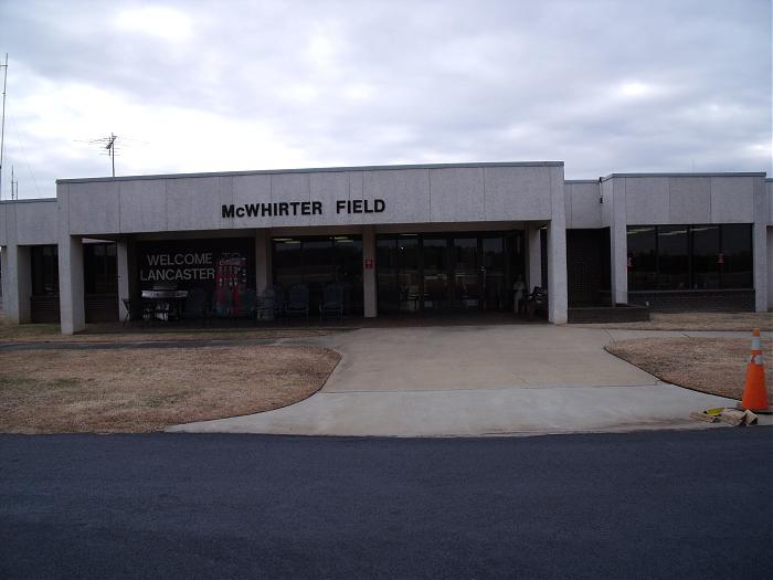
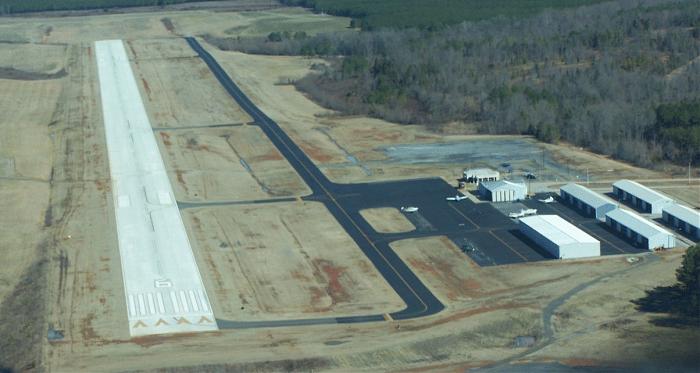
Lancaster County -McWhirter Field- Airport (KLKR)
USA /
South Carolina /
Irwin /
Aviation Blvd., 286
World
/ USA
/ South Carolina
/ Irwin
World / United States / South Carolina
airport, municipal
Airport Identifier: LKR
Elevation: 486 ft / 148.13 m (Surveyed)
Land: 301 acres
From nearest city: 4 nautical miles W of Lancaster, SC
Location: Lancaster County, SC
Magnetic Variation: 07W (2000)
Lancaster County Airport (ICAO: KLKR, FAA LID: LKR), also known as McWhirter Field, is a county-owned, public-use airport located four nautical miles (7 km) west of the central business district of Lancaster, in Lancaster County, South Carolina, United States. Although most U.S. airports use the same three-letter location identifier for the FAA and IATA, this airport is assigned LKR by the FAA but has no designation from the IATA(which assigned LKR to Las Khoreh in Somalia).
286 AVIATION BLVD., LANCASTER SOUTH CAROLINA 29720
803-285-1513 FAX: 803-283-4787
www.mylancastersc.org/index.asp?Type=B_BASIC&SEC={B147B524-37F6-4C9D-A34B-232AECAC846B}
www.airport-data.com/airport/LKR/
www.globalair.com/airport/airport.aspx?aptcode=KLKR
Wikipedia article: http://en.wikipedia.org/wiki/Lancaster_County_Airport
Nearby cities:
Coordinates: 34°43'17"N 80°51'12"W
- Charlotte / Douglas International Airport (CLT/KCLT) 58 km
- McEntire Joint National Guard Base 87 km
- Shaw Air Force Base 87 km
- Greenville-Spartanburg International Airport (GSP/KGSP) 128 km
- Pope Field (POB/KPOB) 174 km
- Piedmont Triad International Airport (GSO) 175 km
- Charleston Air Force Base 212 km
- Charleston International Airport (CHS/KCHS) 214 km
- MCAS Beaufort 247 km
- Hunter Army Airfield 301 km
- Springs Global Inc. : Grace Complex 1.4 km
- Irwin, South Carolina 4.1 km
- Lancaster Mill, South Carolina 6.2 km
- Springdale, South Carolina 7.3 km
- Fishing Creek Lake (Lower) 7.7 km
- Elgin, South Carolina 13 km
- Andrew Jackson State Park 14 km
- Van Wyck, SC 15 km
- Haile Gold Mine 33 km
- Union County, North Carolina 42 km