Habigonj District
Bangladesh /
Habiganj /
Baniachang /
World
/ Bangladesh
/ Habiganj
/ Baniachang
World / Bangladesh / Sylhet / Sylhet / Hobiganj
district, invisible, draw only border, third-level administrative division
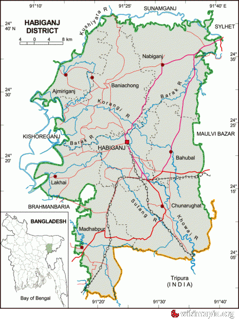

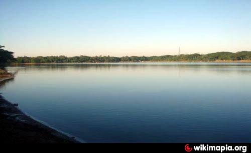
Habiganj District (Sylhet division) with an area of 2636.58 sq km, is bounded by Sunamganj district on the north, Tripura State of India on the south, Maulvibazar and Sylhet districts on the east, Brahmanbaria and Kishoreganj districts on the west. Annual average temperature maximum 33.2°C, minimum 13.6°C. Total rainfall 3334 mm. Noted rivers are Khowai, Sutang, Korangi, Kalni, Kushiyara, Gopala, Ratna, Barak.
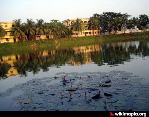
The geographic location of Habingj town centre is 24.3741162N 91.4156914E. Habiganj (Town) consists of 9 wards and 64 mahallas. It has an area of 20.60 sq km. The town has a population of 54178; male 52.59%, female 47.41%. Literacy rate among the town people is 59.9%. Habiganj Town Committee was established in 1881 and it was turned into a municipality in 1913. During the British period an embankment was constructed along the Khoai to protect the town. The main business centre of the town is Chowdhury Bazar. The town has one dakbungalow.
History: It is also the place full of memory of Syed Nasir Uddin(R), an associate of Hazrath Shah Jalal (R) the great saint of Bengal. Historically, Habibganj was a bazaar or ganj beside the river Khowai established by Syed Habib Ullah, the son of Syed Hadaiet Ullah. With the passage of time, Habibganj turned into Habiganj. During the British Raj, Habiganj was established as a Thana (police precinct) in 1790, under Dhaka district (1779–1793). Until 1896, Habiganj's administrative center was in Court Andar, Laskarpur. On 12 September 1874 it came under Sylhet district (part of Assam). Habiganj was declared as subdivision in 1867. On 7 April 1893, according to the Notification no. 273 of Assam Provincial Government, Habiganj Thana (Administrative unit) was established. Habiganj was rejoined with East-Bengal (now Bangladesh) in 1911. Habiganj was established as a District on 1 March 1984. It consists of 4 municipality, 36 wards, 124 mahallas, 8 upazilas, 77 union parishads, 1241 mouzas and 2093 villages. The upazilas are ajmiriganj, baniachang, bahubal, chunarughat, habiganj sadar, lakhai, madhabpur and nabiganj.
As of the 1991 Bangladesh census, population 1757331; male 49.94%, female 50.06%; Muslim 80.23%, Hindu 19.12%, Buddhist 0.05%, Christian 0.13% and others 0.47%; ethnic nationals include Khasia and Manipuri.
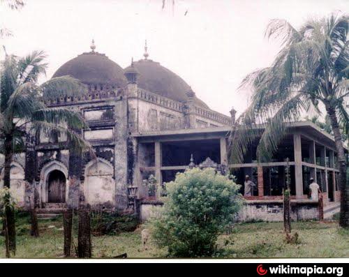
Religious institutions: Mosque 1385, temple 176, church 2, tomb 46.
Literacy and educational institutions: Average literacy 22.51%; male 27.86% and female 17.01%. Educational institutions: medical college 1, polytechnic institute 1, college 14, government high school 8, non-government high school 87, junior school 14, government primary school 1411, non-government primary school 233, madrasa 96, satellite school 6.
Cultural organisations: Club 131, public library 10, library 5, theatre group 12, literary society 6, women's society 7, cinema hall 13.
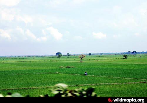
Main occupations: Agriculture 42.26%, agricultural labourer 20.55%, wage labourer 6.45%, commerce 8.2%, service 4.69%, industry 1.7%, fishing 2.73% and others 13.42%.
Land use: Total cultivable land 25299.3 hectares; fallow land 520.53 hectares; single crop 51.6%, double crop 38.7% and treble crop land 9.7%; tea garden 22, rubber plantation 2.
Main crops: Paddy, tea, wheat, potato, jute, ground nut, betel leaf and oil seed.
Fisheries, dairies, poultries Dairy 148, poultry 739 and fishery 638.
Communication facilities- Roads: pucca 321 km, semi pucca 205 km and mud road 1592 km; railways 107 km.
Manufactories: Textile mill, umbrella factory, flour mill, rice mill, ice factory, soap factory, dry fish processing centre, biscuit factory.
Cottage industries: Weaving, bamboo work, goldsmith, blacksmith, potteries, tailoring and welding, shital pati making.
Mineral resources: Natural gas.
NGO activities: Operationally important NGOs are brac, caritas, ccdb, Nijera Kari, asa.
Health centres: Zila sadar hospital 1, upazila health complex 10, union health and family planning centre 28, satellite clinic 1 and maternity 31 and veterinary hospital.
All the reported prehistoric records of Bangladesh are associated with the Lalmai hills and the higher areas of Sylhet, Habiganj, and Chittagong and Madhupur tract.
Khwaja Osman (Afghan king) established a shelter at Putijuri on the foot of the Giripal. He also established a fort at Putijuri, which was extremely important for defense. The Mughal army took the advantage when Khwaja Osman's brother was absent from the fort, and finally defeated the Khwaja Osman's army. In the 17th century, a battle occurred in Baniachang between Anwar Khan (the Zamindar of Sylhet) and Hussain Khan (Baro-Bhuyans of Baniachang) with the Mughal army , which can be found in the Bahrastan-i-Gayebi. In Habiganj Mukti Bahini led by Gen Osmany started their first guerrilla campaign against Pakistani Army.
The geographic location of Habingj town centre is 24.3741162N 91.4156914E. Habiganj (Town) consists of 9 wards and 64 mahallas. It has an area of 20.60 sq km. The town has a population of 54178; male 52.59%, female 47.41%. Literacy rate among the town people is 59.9%. Habiganj Town Committee was established in 1881 and it was turned into a municipality in 1913. During the British period an embankment was constructed along the Khoai to protect the town. The main business centre of the town is Chowdhury Bazar. The town has one dakbungalow.
History: It is also the place full of memory of Syed Nasir Uddin(R), an associate of Hazrath Shah Jalal (R) the great saint of Bengal. Historically, Habibganj was a bazaar or ganj beside the river Khowai established by Syed Habib Ullah, the son of Syed Hadaiet Ullah. With the passage of time, Habibganj turned into Habiganj. During the British Raj, Habiganj was established as a Thana (police precinct) in 1790, under Dhaka district (1779–1793). Until 1896, Habiganj's administrative center was in Court Andar, Laskarpur. On 12 September 1874 it came under Sylhet district (part of Assam). Habiganj was declared as subdivision in 1867. On 7 April 1893, according to the Notification no. 273 of Assam Provincial Government, Habiganj Thana (Administrative unit) was established. Habiganj was rejoined with East-Bengal (now Bangladesh) in 1911. Habiganj was established as a District on 1 March 1984. It consists of 4 municipality, 36 wards, 124 mahallas, 8 upazilas, 77 union parishads, 1241 mouzas and 2093 villages. The upazilas are ajmiriganj, baniachang, bahubal, chunarughat, habiganj sadar, lakhai, madhabpur and nabiganj.
As of the 1991 Bangladesh census, population 1757331; male 49.94%, female 50.06%; Muslim 80.23%, Hindu 19.12%, Buddhist 0.05%, Christian 0.13% and others 0.47%; ethnic nationals include Khasia and Manipuri.
Religious institutions: Mosque 1385, temple 176, church 2, tomb 46.
Literacy and educational institutions: Average literacy 22.51%; male 27.86% and female 17.01%. Educational institutions: medical college 1, polytechnic institute 1, college 14, government high school 8, non-government high school 87, junior school 14, government primary school 1411, non-government primary school 233, madrasa 96, satellite school 6.
Cultural organisations: Club 131, public library 10, library 5, theatre group 12, literary society 6, women's society 7, cinema hall 13.
Main occupations: Agriculture 42.26%, agricultural labourer 20.55%, wage labourer 6.45%, commerce 8.2%, service 4.69%, industry 1.7%, fishing 2.73% and others 13.42%.
Land use: Total cultivable land 25299.3 hectares; fallow land 520.53 hectares; single crop 51.6%, double crop 38.7% and treble crop land 9.7%; tea garden 22, rubber plantation 2.
Main crops: Paddy, tea, wheat, potato, jute, ground nut, betel leaf and oil seed.
Fisheries, dairies, poultries Dairy 148, poultry 739 and fishery 638.
Communication facilities- Roads: pucca 321 km, semi pucca 205 km and mud road 1592 km; railways 107 km.
Manufactories: Textile mill, umbrella factory, flour mill, rice mill, ice factory, soap factory, dry fish processing centre, biscuit factory.
Cottage industries: Weaving, bamboo work, goldsmith, blacksmith, potteries, tailoring and welding, shital pati making.
Mineral resources: Natural gas.
NGO activities: Operationally important NGOs are brac, caritas, ccdb, Nijera Kari, asa.
Health centres: Zila sadar hospital 1, upazila health complex 10, union health and family planning centre 28, satellite clinic 1 and maternity 31 and veterinary hospital.
All the reported prehistoric records of Bangladesh are associated with the Lalmai hills and the higher areas of Sylhet, Habiganj, and Chittagong and Madhupur tract.
Khwaja Osman (Afghan king) established a shelter at Putijuri on the foot of the Giripal. He also established a fort at Putijuri, which was extremely important for defense. The Mughal army took the advantage when Khwaja Osman's brother was absent from the fort, and finally defeated the Khwaja Osman's army. In the 17th century, a battle occurred in Baniachang between Anwar Khan (the Zamindar of Sylhet) and Hussain Khan (Baro-Bhuyans of Baniachang) with the Mughal army , which can be found in the Bahrastan-i-Gayebi. In Habiganj Mukti Bahini led by Gen Osmany started their first guerrilla campaign against Pakistani Army.
Wikipedia article: http://en.wikipedia.org/wiki/Habiganj_District
Nearby cities:
Coordinates: 24°22'48"N 91°25'46"E
- Maulvibazar District 50 km
- Khagrachari District 78 km
- Sylhet District 92 km
- Rangamati District 93 km
- Chattogram District Area 156 km
- Noakhali District 160 km
- Bhola District 211 km
- Zhemgang Dzongkhag 347 km
- Lhuentse Dzongkhag 415 km
- District Upper Siang (AP) 618 km
- Habiganj Dist Town 1.4 km
- Bahubal Upazila HQ 12 km
- Deundi Tea Estate 21 km
- Chunarughat Upazila HQ 22 km
- Haail Haaor 25 km
- Fisheries 27 km
- Gias Nagar, U.C 12, Moulvi bazar 31 km
- Maulvibazar District Town 37 km
- Sylhet Division 39 km
- Tripura 80 km
Comments