Holly Sugar, Santa Ana (site) (Santa Ana, California)
USA /
California /
Santa Ana /
Santa Ana, California
World
/ USA
/ California
/ Santa Ana
World / United States / California
place with historical importance, production

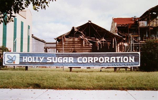
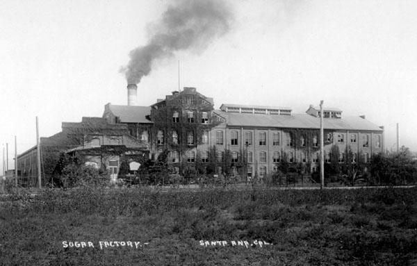
Former location of the iconic Holly Sugar plant. It was built in 1912 by the Santa Ana Co-Operative Sugar Co. -- formed by James Irvine in 1911 so he could get better prices for his sugar beets -- and bought out by Holly in 1918. Orange County had four sugar factories during World War I, when the county was supplying a fifth of the nation's refined sugar. By 1930, only Santa Ana's, then owned by Holly Sugar Co., was still operating. Holly closed the plant in 1982 and it was demolished in 1983. Dyer Road is named after the designer and builder of the factory, the Dyer Company of Cincinnati, OH.
Wikipedia article: http://en.wikipedia.org/wiki/Imperial_Sugar
Nearby cities:
Coordinates: 33°42'37"N 117°51'20"W
- Tustin Legacy (Former Marine Corps Air Station Tustin) 1.6 km
- MCAS Tustin Blimp Hangаrs 2.7 km
- Santa Ana Army Air Base (site) 6.8 km
- Salt Dike - Newport Back Bay 7.2 km
- Quail Hill Preserve 7.4 km
- Naval Outer Landing Field, Mile Square (site) 8.9 km
- Former location of Orange County Country Club (Santa Ana CC) 11 km
- Crystal Cove State Park 14 km
- San Onofre Nuclear Generating Station (Mesa) 46 km
- Disused Mobile Target Range 58 km
- Skypark Business Center 2.3 km
- South Coast Metro 2.7 km
- Tustin Legacy (Former Marine Corps Air Station Tustin) 2.9 km
- The District at Tustin Legacy 3.1 km
- Columbus Square 3.2 km
- Columbus Grove Irvine 4.1 km
- Westpark Village 4.6 km
- Westpark II Village 4.6 km
- Woodbridge Village 6.3 km
- Orange County, California 10 km