Likas Ridge Hiking Trail (Kota Kinabalu)


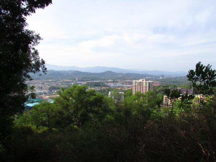


A hiking path up to the very top of Likas Ridge which is divided into two distinct parts. The first part is a flight of stairs located behind Public Jaya Apartment 1 which leads to a hut near to the covered carpark below Public Jaya Apartment 2. The trail then levels for a bit, before going uphill again, where at this point, a partial view of Likas Bay can be seen. Going on further will reveal a higher view over the apartment blocks below, as well as a nice view of KK city, including Kolombong. Hikers would then come across an 'intersection', where a bench has been constructed. Go straight on to reach the ridge's trigonometrical station at 127.4 metres above sea level. The trail then thins out, but leads to several village homes down below.
The hike along this trail is quite relaxing, and can be completed in just over an hour. It is a good place to get a rare view of KK city.
The hike along this trail is quite relaxing, and can be completed in just over an hour. It is a good place to get a rare view of KK city.
Likas Ridge Hiking Trail, related objects
Nearby cities:
Coordinates: 5°58'59"N 116°6'23"E
- Likas Ridge 0.2 km
- Taman Seri Borneo 1.2 km
- Likas 1.3 km
- Taman Iramanis 1.4 km
- BDC Milek Perkasa Industrial Estate 1.5 km
- Kolombong 1.7 km
- Taman BDC 1.8 km
- Taman BDC 2 km
- Taman Dai Ming Baru 2 km
- Taman Khidmat 2.3 km
- Lorong Ranggung Batek 0.6 km
- Likas Bay Road 0.9 km
- Fung Yei Ting Road 1.4 km
- Istiadat Road 1.7 km
- Pinggir Road 3.1 km
- Sena Road 3.2 km
- Gaya Street 3.2 km
- Coastal Highway 5 km
- Laya Laya Housing Road 21 km
- Kent Avenue 26 km