Marion County Airport (MAO)
USA /
South Carolina /
Marion /
SR-34-527, 225
World
/ USA
/ South Carolina
/ Marion
World / United States / South Carolina
airport, municipal
Airport Identifier: MAO
Elevation: 92 ft / 28.04 m (Surveyed)
Land: 130 acres
From nearest city: 3 nautical miles E of Marion, SC
Location: Marion County, SC
Magnetic Variation: 06W (1985)
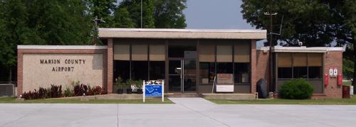
Marion County Airport is a general aviation airport first opened in 1963 as a grass strip! Many new and exciting projects have been completed recently to help bring the ultimate in convenience and service to our airport. Along with a brand new apron, you will find a full service Fixed Base Operator, Shell jet fuel, and 100LL Avgas.
Open to the public. Attended 0700-1700 local time.
Runway 4/22: 4503x100
Fuel: 100LL, Jet A
225 State Road S-34-527, Mullins, SC 29574-6013, United States
(843) 423-8265
www.marionsc.org/airport
www.airport-data.com/airport/MAO/
www.airnav.com/airport/KMAO
www.globalair.com/airport/airport.aspx?aptcode=KMAO
Elevation: 92 ft / 28.04 m (Surveyed)
Land: 130 acres
From nearest city: 3 nautical miles E of Marion, SC
Location: Marion County, SC
Magnetic Variation: 06W (1985)
Marion County Airport is a general aviation airport first opened in 1963 as a grass strip! Many new and exciting projects have been completed recently to help bring the ultimate in convenience and service to our airport. Along with a brand new apron, you will find a full service Fixed Base Operator, Shell jet fuel, and 100LL Avgas.
Open to the public. Attended 0700-1700 local time.
Runway 4/22: 4503x100
Fuel: 100LL, Jet A
225 State Road S-34-527, Mullins, SC 29574-6013, United States
(843) 423-8265
www.marionsc.org/airport
www.airport-data.com/airport/MAO/
www.airnav.com/airport/KMAO
www.globalair.com/airport/airport.aspx?aptcode=KMAO
Nearby cities:
Coordinates: 34°10'53"N 79°20'4"W
- Shaw Air Force Base 109 km
- Pope Field (POB/KPOB) 115 km
- McEntire Joint National Guard Base 140 km
- Charleston International Airport (CHS/KCHS) 156 km
- Charleston Air Force Base 156 km
- Charlotte / Douglas International Airport (CLT/KCLT) 190 km
- Piedmont Triad International Airport (GSO) 223 km
- MCAS Beaufort 228 km
- Greenville-Spartanburg International Airport (GSP/KGSP) 278 km
- Hunter Army Airfield 295 km
- Marion County Medical Center 1.1 km
- Mullins High School 5.7 km
- Marion High School 5.8 km
- former Blumenthal Print Works (closed) 7.2 km
- Rains, South Carolina 10 km
- Creek Bridge Middle/High School 16 km
- Galivants Ferry, South Carolina 16 km
- Centenary, South Carolina 17 km
- Ketchuptown, SC 19 km
- Robeson County, North Carolina 53 km