Jordan Valley
Jordan /
Irbid /
al-Balawinah /
World
/ Jordan
/ Irbid
/ al-Balawinah
, 5 km from center (البلاونه)
World / Palestinian territories / West Bank
valley, invisible


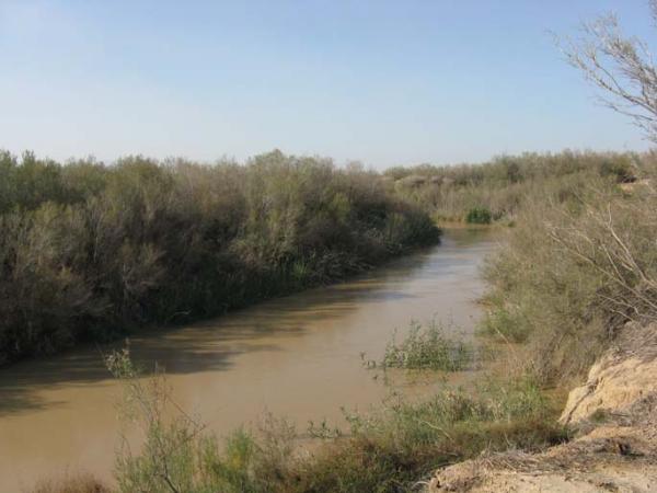

The Jordan Valley (Hebrew: עמק הירדן) (Emek Hayarden) forms part of the larger Jordan Rift Valley. It is 120 kilometers long and 15 kilometers wide, where it runs from Lake Tiberias in the north to northern Dead Sea in the south. It runs for an additional 155 kilometer south of the Dead Sea to the Gulf of Aqaba at Aquaba, an area also known as Wadi Arabah or the Arava valley (see separate tag). It forms the border between Israel and Jordan in the north, and the eastern strip of the West Bank in the south. In 2009, the population of the Jordan Valley was 400,000.
Wikipedia article: http://en.wikipedia.org/wiki/Jordan_Valley_(Middle_East)
Nearby cities:
Coordinates: 32°14'1"N 35°33'23"E
- Wadi Araba 152 km
- Wadi Rum 276 km
- Aref Canyon 440 km
- Wadi Houran 457 km
- Karasu (al-Aswad) River Valley 521 km
- Çukurova (Plain) 536 km
- Wadi Qena 568 km
- Cilician Gates 599 km
- Muş Valley 910 km
- Wadi al Gubba 1288 km
- السيد ابو يزيد الصليبي 3 km
- السيد ابو يزيد الصليبي 3 km
- Farm of Mahmoud 3.3 km
- Hemdat 3.4 km
- مزرعة الاستاذ احمد عبدالهادي ابوصليح وشريكه 4.6 km
- Marj Na'jah 5.8 km
- Argaman 7.6 km
- Deir Alla 15 km
- Bik'at HaYarden 19 km
- Judea and Samaria ("West Bank") 45 km
Comments