Lighthouse Nieuwpoort
Belgium /
West-Flandern /
Nieuwpoort /
Oude Zeedijk
World
/ Belgium
/ West-Flandern
/ Nieuwpoort
World / Belgium / Vlaanderen / West-Vlaanderen / Veurne
lighthouse, listed building / architectural heritage, 20th century construction


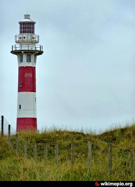
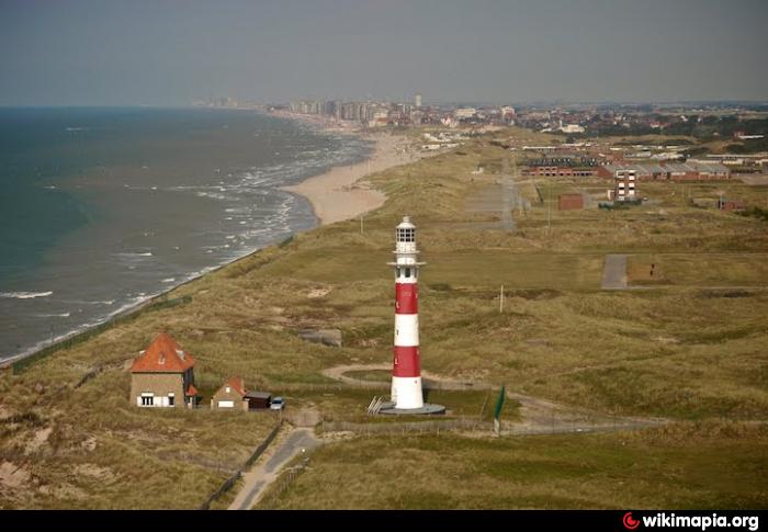


This lighthouse stands Eastern of the port entrance. The first report of light for fishermen at Nieuwpoort descends from 1284.
In 1881, rebuild out of stone, which have been destroyed in 1914, by the Belgian army during WWI. Rebuild in 1923, however destroyed again on September 7 1944.
Since 1986 the towers light is activated by a light sensor.
Is also used as the marking point center radius for the safety border for the artillery firing range.
Nearby cities:
Coordinates: 51°9'16"N 2°43'47"E
- Trinity House Lightvessel 17 (LV 17) 58 km
- North Foreland Lighthouse 93 km
- The Drop Redoubt 99 km
- Lightvessel Sunk 101 km
- Gunfleet Lighthouse 118 km
- Scheveningen pier 151 km
- Royal Sovereign Lighthouse 168 km
- The Belle Tout Lighthouse 182 km
- Trinity House Lightvessel 5 (LV 5) 208 km
- Sémaphore de Fécamp 228 km
- Amphibious Landing Exercise Beach 0.2 km
- Quarters Kamp van Lombardsijde 0.2 km
- Simli neighborhood 1.3 km
- 4 km Seaward Artillery Practice Area 2.2 km
- Westende-Bad 3.6 km
- Spaarbekken 3.9 km
- Nieuwpoort (municipality) 3.9 km
- Dunes 5.2 km
- 12 km Seaward Artillery Practice Area 7.1 km
- 20 km Seaward Artillery Practice Area 12 km