Georgian Military Road
Georgia /
Mtskheta-Mtianeti /
Sioni /
World
/ Georgia
/ Mtskheta-Mtianeti
/ Sioni
World / Georgia (country) / Mtskheta-Mtianeti
road, invisible

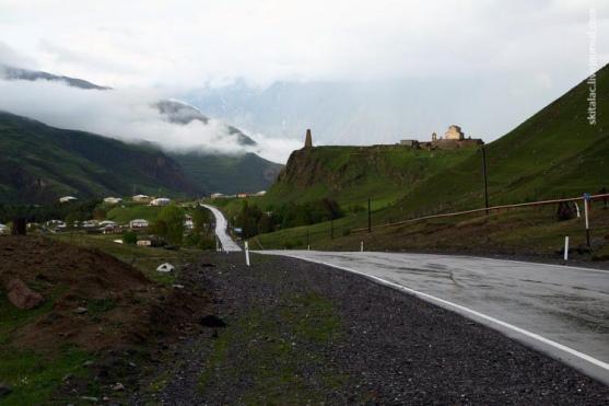
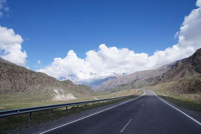


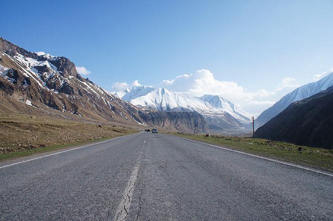
The 208 kilometers long Georgian Military Road runs between Tbilisi (Georgia) and Vladikavkaz (Russia) and follows the traditional route used by invaders and traders throughout the ages.
Known since antiquity (it was mentioned by Strabo in his Geographica and by Pliny, the Georgian Military Road in its present form was begun by the Russian military in 1799. After the Kingdom of Georgia was annexed by the Russian Empire in 1801, Tsar Alexander I ordered General Aleksey Petrovich Yermolov, commander-in-chief of Russian forces in the Caucasus to improve the surfacing of the road to facilite troop movement and communications. When Yermolov announced the completion of work in 1817, the highway was heralded as the “Russian Simplon”. However, work continued until 1863.
Known since antiquity (it was mentioned by Strabo in his Geographica and by Pliny, the Georgian Military Road in its present form was begun by the Russian military in 1799. After the Kingdom of Georgia was annexed by the Russian Empire in 1801, Tsar Alexander I ordered General Aleksey Petrovich Yermolov, commander-in-chief of Russian forces in the Caucasus to improve the surfacing of the road to facilite troop movement and communications. When Yermolov announced the completion of work in 1817, the highway was heralded as the “Russian Simplon”. However, work continued until 1863.
Wikipedia article: http://en.wikipedia.org/wiki/Georgian_Military_Road
Nearby cities:
Coordinates: 42°33'59"N 44°34'33"E
- ზოგიშიდან მიმავალი გზა, ამავე სოფლის ისტორიული ციხე-სიმაგრისაკენ. მანძილი არაუმეტეს 1.500 კმ.ისა.ზ.დ 650-900მ. 143 km
- Rustaveli St. 178 km
- Solomon II St. 178 km
- Tamar St. 178 km
- Shabtai Tzur (Former Sanapiro) St. 178 km
- Tavisupleba St. 178 km
- Otar Lortkipanidze (former Gorgasali) Str. 179 km
- Revolutsia St. 179 km
- Titsian Tabidze St. 179 km
- goderdzi pass 200 km
- Sioni commune 3.8 km
- Kazbegi District (Khevi) 4.7 km
- Kobi commune 6.1 km
- Goristsikhe commune 6.5 km
- Sno Gorge 11 km
- Mna Valley 13 km
- Ghudi gorge (Gudauri) 15 km
- Kistis Khevi 17 km
- Truso valley 18 km
- Mtiuleti 19 km