Bagac
Philippines /
Central Luzon /
Bagac /
World
/ Philippines
/ Central Luzon
/ Bagac
World / Philippines / Bataan / Bagac
town, municipality, third-level administrative division
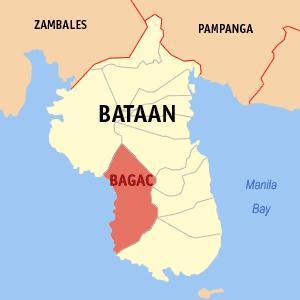

Municipality of Bagac, Province of Bataan
Land Area: 231.20 km²
ZIP Code: 2107
Bagac is a coastal municipality in the province of Bataan in the Philippines. It had a population of 25,568 people as registered in the 2010 Census. The town has the biggest land area in the whole province.
Bagac is an agricultural municipality which became famous during World War Two. The infamous Death March by Filipino-American troops who surrendered to the Japanese forces started from Bagac.
The municipality is a tourism destination in the province of Bataan. It boasts of sandy white sand beaches, corals and tropical green forests. Travel time by car to Bagac from Metropolitan Manila usually takes two hours and three hours by public transportation.
MyBataan Webpage: www.mybataan.com/content/view/75/249/
Wikipedia article: http://en.wikipedia.org/wiki/Bagac,_Bataan
Nearby cities:
Coordinates: 14°34'57"N 120°25'6"E
- Subic 56 km
- Capas 96 km
- Botolan 98 km
- San Jose 111 km
- Candelaria 137 km
- Mangatarem 145 km
- Santa Cruz 155 km
- Mabini 183 km
- Bokod 226 km
- Kayapa 229 km
- A.D.FARM 3.6 km
- A.D. FARM 4.3 km
- Pantingan Peak 8.6 km
- Mount Mariveles Crater 9 km
- Vintana Peak 10 km
- Mount Mariveles 10 km
- Mount Samat 10 km
- EL SACO PEAK 11 km
- Bataan 11 km
Comments