Mount Mariveles (Mariveles)
| mountain, volcano
Philippines /
Central Luzon /
Mariveles
World
/ Philippines
/ Central Luzon
/ Mariveles
World / Philippines / Bataan / Bagac
mountain, volcano

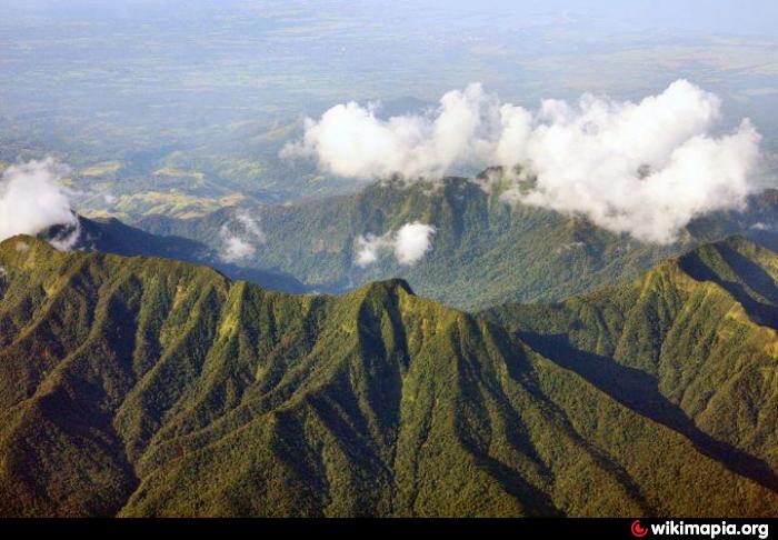
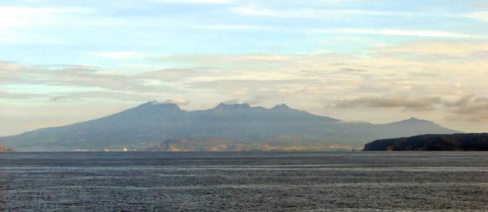
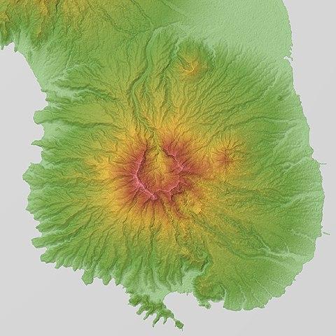
Mount Mariveles is a dormant stratovolcano and the highest point in the province of Bataan in the Philippines. Mariveles and the adjacent Mount Natib comprise 80.9 percent of the total land area of the province. The mountain and adjacent cones lie opposite the city of Manila across Manila Bay, providing a beautiful setting for the sunsets seen from the city.
Wikipedia article: http://en.wikipedia.org/wiki/Mariveles_Volcano
Nearby cities:
Coordinates: 14°31'8"N 120°29'14"E
- Mt. Palay Palay National Park 35 km
- DAX MINING & QUARRY 59 km
- Mount Barigon 73 km
- Mount Pinatubo 78 km
- Mount Santa Cruz 84 km
- Mount Arayat 84 km
- Mount Cunonoyo 89 km
- Mt. Ugo 205 km
- Mt. Gabo 223 km
- Mt. Pulag 243 km
- Mount Mariveles Crater 1.2 km
- Tarak Ridge 1.3 km
- Pantingan Peak 2.3 km
- Malaya 7.6 km
- Mariveles Town Proper 9 km
- Porto Del Sol Subdivision 9 km
- Camaya Coast - Commercial Area 10 km
- Camaya Coast Station 2 10 km
- The Mariveles Cove 11 km
- Bataan 19 km