Balkanski Rozi Hut
Bulgaria /
Plovdiv /
Karlovo /
World
/ Bulgaria
/ Plovdiv
/ Karlovo
, 4 km from center (Карлово)
World / Bulgaria / Plovdiv
mountain hut, 1933_construction
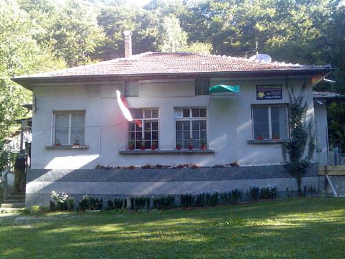
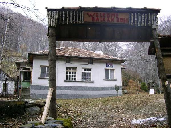
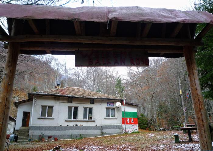
The hut was built in 1933 by the Red Cross.
It is situated within the territory of Stara Reka Reserve, at 1,156 m above the sea level, on the path to Hubavets and Vasil Levski Huts. It consists of two one-storey buildings with total capacity of 50 beds, allocated in rooms with 2, 4 and more beds.
GPS: N42.69886 E24.82723
www.tourism.bg-market.com/roses/index.html
visitcentralbalkan.net/tourism/chalets/balkanski-rozi-b...
bit.ly/39NXAOI
bgglobe.net/chalets/balkanski-rozi-balkan-roses-hut-988
bulrest.com/en/properties/karlovo/balkanski-rozi-hut-29...
Nearby cities:
Coordinates: 42°41'55"N 24°49'37"E
- Sliven Municipality Hall 122 km
- Bolshaya Morskaya ulitsa / vulytsia Velyka Morska, 50 731 km
- Politekhnichnyi provulok, 1/33 964 km
- Officers' club 966 km
- Krasnaya ploshchad, 6 1319 km
- ulitsa Tsiolkovskogo, 13 1472 km
- ZiL cultural center 1717 km
- Headquarters of the Federal Security Service of the Russian Federation (old building) 1720 km
- Ministry of Agriculture 1722 km
- ulitsa Fridrikha Engelsa, 31/35 1724 km
- Stara Reka Reserve 1.4 km
- Grebena Locality 4.4 km
- Sopot Municipality 6.2 km
- Novoselski Polenitsi Locality 6.6 km
- Central Balkan National Park 13 km
- Karlovo Municipality 13 km
- Apriltsi Municipality 14 km
- Troyan Municipality 23 km
- Rozovata Dolina (Rose Valley) 30 km
- Sevlievo Municipality 38 km