Rankin Bridge
USA /
Pennsylvania /
Rankin /
World
/ USA
/ Pennsylvania
/ Rankin
World / United States / Pennsylvania
road bridge, cantilever bridge
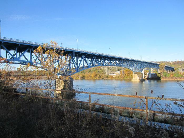
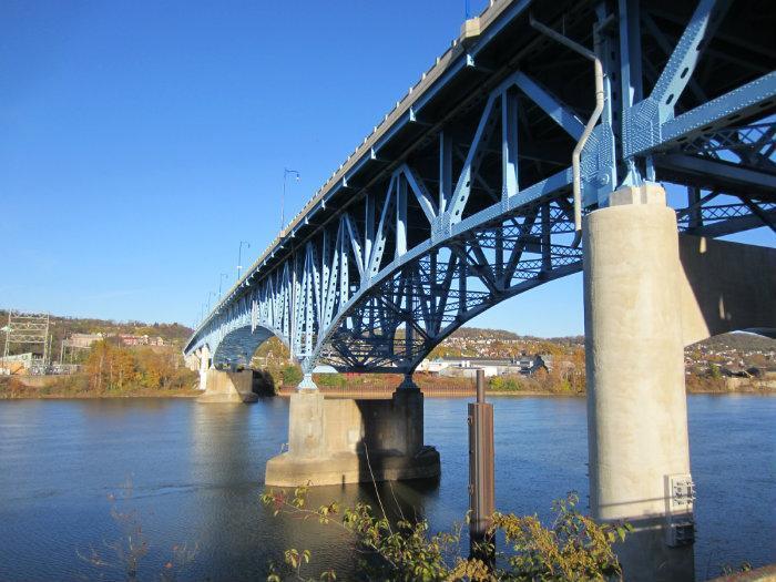
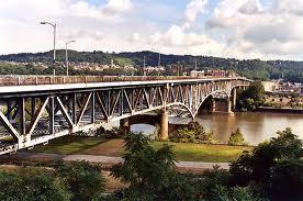
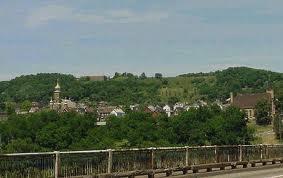
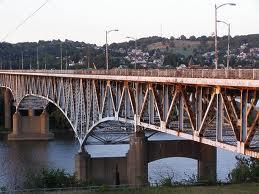
Built in 1951, the Rankin Bridge crosses the Monongahela River between the boroughs of Rankin and Whitaker. It is a major traffic artery between Pittsburgh's eastern and southern suburbs, and also serves communities in the Monongahela River Valley. Traffic from the Parkway East (I-376) utilizes the Rankin Bridge for access to nearby Kennywood Park.
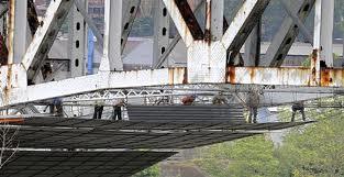
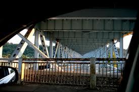
In recent years, the bridge has fallen into disrepair, with rust visible on the superstructure, and steel rebar visible on the bridge deck. Work to rehabilitate the bridge began in 2008, and is expected to finish in 2010.
In recent years, the bridge has fallen into disrepair, with rust visible on the superstructure, and steel rebar visible on the bridge deck. Work to rehabilitate the bridge began in 2008, and is expected to finish in 2010.
Wikipedia article: http://en.wikipedia.org/wiki/Rankin_Bridge
Nearby cities:
Coordinates: 40°24'23"N 79°52'47"W
- Homestead Grays Bridge 3.6 km
- Washington Crossing Bridge 11 km
- Fort Duquesne Bridge 12 km
- McKees Rocks Bridge 17 km
- I-79 Neville Island Bridge 25 km
- Stan "the Man" Musial Bridge 27 km
- Lane Bane Bridge 42 km
- Pfc. Ronald "Smokey" Bakewell Memorial Bridge 45 km
- Hi Carpenter Memorial Bridge 161 km
- Williamstown Interstate Bridge 173 km
- Rankin, Pennsylvania 0.5 km
- Braddock, Pennsylvania 1 km
- Swissvale, Pennsylvania 1.8 km
- Braddock Hills, Pennsylvania 2.2 km
- North Braddock, Pennsylvania 2.2 km
- Munhall, Pennsylvania 2.2 km
- The Waterfront 2.7 km
- Forest Hills, Pennsylvania 2.8 km
- West Mifflin, Pennsylvania 5.6 km
- North Versailles Township 6.5 km