Stoykite
Bulgaria /
Smoljan /
World
/ Bulgaria
/ Smoljan
/ Smoljan
, 10 km from center (Смолян)
World / Bulgaria / Smolyan
village
Add category

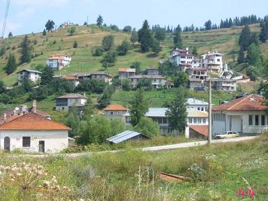
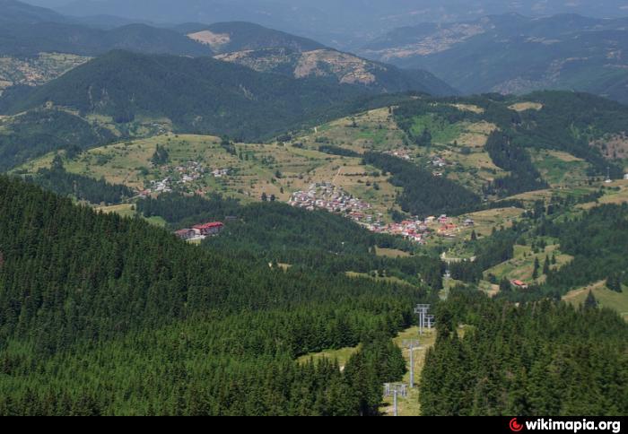
The village of Stoykite lies in the center of the southern half of Bulgaria, in the very heart of the Rhodope Mountains, 15 km away from the county town of Smolyan and only 7 km away from the winter resort of Pamporovo. It is surrounded by varied landscape. The huge elevation of Mount Perelik goes to the southwest through the Eshei Kulak pass and Mount Cherni Vrah to the Mount Snezhanka. At the northeast stands the continuation of the Chernatitsa Mountain - Kara Tepe and Mechi Chal - that delimitates the basins of the rivers Vacha and Asenitsa. The average altitude is 1,410 m. Therefore, the summer in Stoykite is cool and the winter is soft.
Stoykite is 250 km away from the capital Sofia and 90 km away from the second largest city in Bulgaria - Plovdiv, which has its airport for charter flights.
www.mirela.bg/en/prodava-imoti/%D1%81-%D0%A1%D1%82%D0%B...
www.visittobulgaria.com/visit/all_places_a-z/stoikite
Stoykite is 250 km away from the capital Sofia and 90 km away from the second largest city in Bulgaria - Plovdiv, which has its airport for charter flights.
www.mirela.bg/en/prodava-imoti/%D1%81-%D0%A1%D1%82%D0%B...
www.visittobulgaria.com/visit/all_places_a-z/stoikite
Nearby cities:
Coordinates: 41°39'18"N 24°38'8"E
- Sokolovtsi 10 km
- Momchilovtsi 11 km
- Kutela 15 km
- Polkovnik Serafimovo 17 km
- Dzhurkovo 20 km
- Taran 22 km
- Starnitsa 22 km
- Srednogortsi 26 km
- Bosilkovo 26 km
- Leska 29 km
- "Stoykite - Snezhanka" - Lift 6 2.6 km
- Malina Ski Center 3.6 km
- Vila Malina - Village recreation 4.2 km
- Pamporovo 4.5 km
- Evridika Hotel 4.7 km
- Manastirite Hotel 4.8 km
- Mechi Chal Ski Lift 6.1 km
- Smolyan Municipality 8.7 km
- Chepelare Municipality 14 km
- Rhodope National Park 31 km