Border sign
| boundary marker
Finland /
Kymenlaakso /
Virolahti /
World
/ Finland
/ Kymenlaakso
/ Virolahti
World / Finland / Southern Finland / Kymenlaakso / Kotka-Hamina
boundary marker
Add category

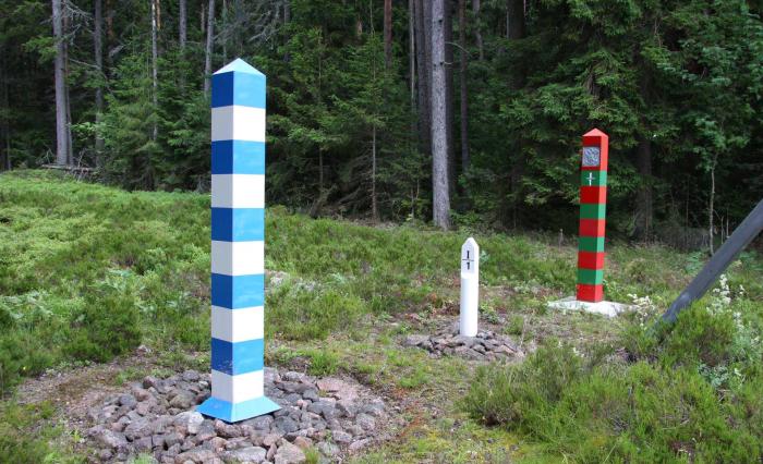
Russian/Suomi border sign I/1 is here.
Nearby cities:
Coordinates: 60°32'44"N 27°47'48"E
- RUS-FIN border sign I/4 is here 1.4 km
- Border sign VI/1 1.5 km
- RUS-FIN border sign I/15 is here 4.4 km
- Border sign VI/3a 4.6 km
- Border sign VI/3 4.9 km
- RUS-FIN border sign I/31 is here 17 km
- RUS-FIN border sign I/49 is here 25 km
- RUS-FIN border sign I/56 is here 29 km
- Easternmost point of Finland, small nonamed island on the Virmajärvi lake 330 km
- Border sign N662 is here. 397 km
- Zheleznovsky Peninsula 1.6 km
- Grozny island 3.4 km
- Ivovy island 5.5 km
- Primorskoye 6.5 km
- Bolshoy Pogranichny island 6.5 km
- Dolgy Kamen island 10 km
- Kozliny island 11 km
- Chistopolskaya Bay 13 km
- Portovaya Bay 17 km
- Konyok Peninsula 18 km