Zlatibor
Serbia and Montenegro /
Central Serbia /
Zlatibor /
World
/ Serbia and Montenegro
/ Central Serbia
/ Zlatibor
, 3 km from center (Златибор)
World / Serbia / Zlatiborski
mountain, invisible

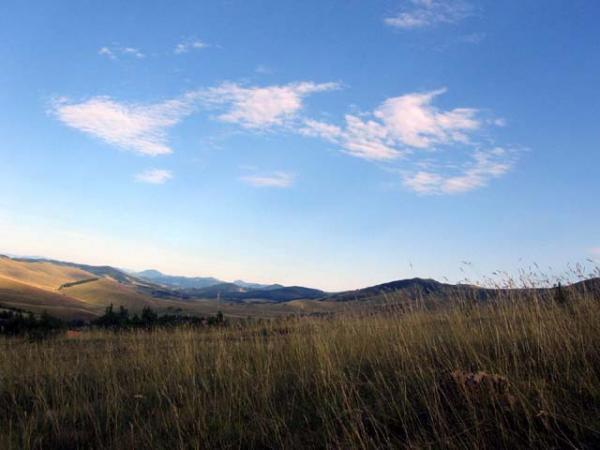


Zlatibor (Serbian Cyrillic: Златибoр) is a mountain region situated in the western part of Serbia, a part of the Dinaric Alps.
The mountain range spreads over an area of 300 km², 27 miles in length, southeast to northwest, and up to 23 miles in width. The highest peak is Tornik at 1496 m. Zlatibor is situated between 43° 31' N, and 43° 51' N, and between 19° 28' E, and 19° 56' E
Situated at an altitude of just over 1,000 meters, Zlatibor is a climatic resort, characterised by a cool mountain climate, clean air, long periods of sunshine during the summer and a heavy snow cover in winter. Tourist facilities include modern hotels, holiday centers and cottages, sports grounds and skiing.
Wikipedia article: http://en.wikipedia.org/wiki/Zlatibor
Nearby cities:
Coordinates: 43°41'19"N 19°41'26"E
- Golija 46 km
- Goch mountain (planina Goč) 83 km
- Gledić mountains 95 km
- Jastrebac Mountain 121 km
- Juhor mountain 123 km
- Homolje mountains 167 km
- Rtanj Mountain 168 km
- Suva Planina 190 km
- Svrljig Mountains 191 km
- Locvei Mountains 192 km
- Ski Resort Tornik 4.1 km
- Обудојевица 4.2 km
- Zlatibor 4.5 km
- vodice 6.7 km
- Zlatici 12 km
- gostilje 12 km
- Bela Zemlja 17 km
- Узићи 28 km
- Municipality of Arilje 28 km
- Berbati 31 km
Comments