Jastrebac Mountain
Serbia and Montenegro /
Central Serbia /
Blace /
World
/ Serbia and Montenegro
/ Central Serbia
/ Blace
, 22 km from center (Блаце)
World / Serbia / Rasinski
mountain, park, invisible
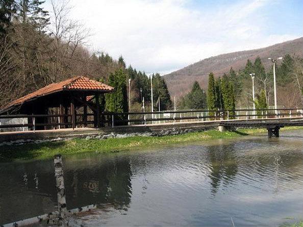


Jastrebac (Serbian Cyrillic: Јастребац) is a mountain in central Serbia, between cities of Niš, Kruševac and Prokuplje. It consists of two massifs, Great (Veliki) and Small (Mali) Jastrebac. Its highest peak Velika Đulica has an altitude of 1492 metres above sea level. It is well-forested and presents a popular hiking and mountaineering destination.
Jastrebac is bounded by the rivers of South Morava on the west, Toplica on the south and Rasina on the east. Despite relatively low height, it is prominent because of the surrounding valleys. It is located on the boundary of Dinaric, Balkan and Rhodopes mountain ranges, but cannot be clearly classified into either.
Jastrebac is bounded by the rivers of South Morava on the west, Toplica on the south and Rasina on the east. Despite relatively low height, it is prominent because of the surrounding valleys. It is located on the boundary of Dinaric, Balkan and Rhodopes mountain ranges, but cannot be clearly classified into either.
Wikipedia article: http://en.wikipedia.org/wiki/Jastrebac
Nearby cities:
Coordinates: 43°23'44"N 21°27'48"E
- Suva Planina 43 km
- Svrljig Mountains 45 km
- Rtanj Mountain 52 km
- Juhor mountain 64 km
- Goch mountain (planina Goč) 65 km
- Gledić mountains 76 km
- Golija 102 km
- Homolje mountains 113 km
- Zlatibor 157 km
- Locvei Mountains 169 km
- srndalje 4.9 km
- Ribarska Banja 5 km
- Zubovac 9 km
- Prevoj Grebac 635 m 10 km
- Ljupten 10 km
- Kamenica 13 km
- Krajkovac Lake 14 km
- Prokuplje Municipality 22 km
- Merošina Municipality 23 km
- Aleksinac Municipality 25 km