Cang-inte
Philippines /
Central Visayas /
Siquijor /
World
/ Philippines
/ Central Visayas
/ Siquijor
World / Philippines / Siquijor / Siquijor
village
Add category
I. BRIEF DESCRIPTION OF BARANGAY CANG-INTE
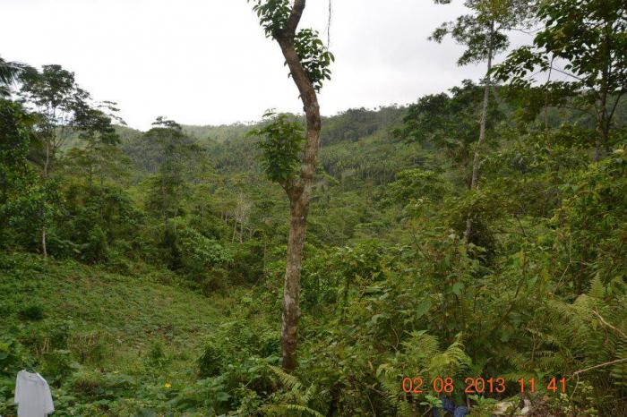
Cang-inte is an upland barangay in the Municipality of Siquijor, Province of Siquijor. It is geographically located at the heart of the municipality that lies nine (9) kilometers south-east from the town proper and a few kilometers away from Camp Bandilaan – the center point of the island province.
The total land area of the barangay is 165,452 hectares with not more than 50 households and 215 residents based on May 01, 2010 census. The primary source of living of the people of Cang-inte is farming although some are also indulge in vegetable gardening, fishing and livestock raising.
II. HISTORY
According to Cang-inte folks, the barangay was first known as Kabutongan and Buacbato, the two (2) separate villages headed by its respective chief captains. Kabutongan was named due to its abundance of butong (young coconut fruit) while Buacbato was named due to its numerous broken stones and beautiful rock formations found in the village. “Buac” is the bisayan term for broken and “Bato” for stone.
During the transition period of the Philippine government from Spanish to American leadership, two (2) village captains named Cangtilyo and Teyo worked together in merging the 2 village into a barangay. The newly created barangay was named Cang-inte by combining the names of the 2 political leaders; “Cang” for Cangtelyo, AND pronounced as “In”, and “Te” for Teyo.
At present, the two villages remain as twin sitio in the highland barangay of Cang-inte. Sitio Buacbato “Purok Langin” in the north and Sitio Kabutongan “Purok Mahogany” in the south. The two main sitios are then subdivided into several sub-sitios called by the locals of Cang-inte to a particular hills, valleys, and mountain forest. These are Sitio Cang-arag, Kabal-asan, Napayong, Alasanan, Buntod, Taas-daro and several others.
III. CULTURE/BELIEFS/RELIGION
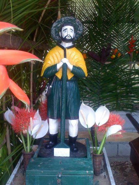
The people of Cang-inte are 100% Roman Catholic. Most are devotees of St. Isidore, the patron saint of the farmers. The chapel of St. Isidore was built in early 1900 at Sitio Kabutongan and its annual fiesta is celebrated every 14th-15th day of May. Other feasts gathering are the 40 days novena ending every January 11 as Second Devotes Fiesta Celebration and the “Sugat / Barangay Bisita Iglisias” every month of July.
In addition to the above fiesta, some group and family clans of Sitio Kabutongan celebrate the feast of harvest and other ritual rights as they call themselves “Anad / Ginam-an”. These beliefs are inherited from Cang-inte great ancestors and were passed through generation to generations.
IV. POLITICS AND “PEACE & ORDER” SITUATION
Cases of crimes are very minimal and usually at 0% crime rate per annum. Most of the cases raised to the barangay are minor conflicts that can be easily settled by the Barangay Council or Lupong Tagapamayapa. Only in rare cases involving land disputes were forwarded to proper authorities for judicial action.
PREVIOUS VILLAGE LEADERS AND BARANGAY CAPTAINS
Cangtilyo
Tiyo
Francisco Apiag / Kabisa Isko
Isidoro Apiag
Cayetano Apiag
Pedro Baroro
Timoteo Bati-on
Ramon Paghaci-an Sr. Tomas Bati-on (1982-1988)
Flaviano Balos (1988-1994)
Joselito Magaluna (1994-1997)
Francisco Balos (1997-2007)
Ramon Paghaci-an Jr. (2007-2010)
Jerry Paghaci-an (2010-2012)
Ryan Catubig (2012-2013)
Sergia Patagoc (2013 – present)
V. POPULATION
The population of barangay Cang-inte is one of the smallest in the entire province of Siquijor. As of the end of 2013 there are a total of 192 inhabitants comprised of 100 males and 92 females or almost 1:1 gender equality ratio. The same census also states that Cang-inte has 43 households with an average household size of 4.47 persons and an average annual growth rate of 1.01% between 2007 and 2013.
POPULATION CENCUS OF BARANGAY CANG-INTE
YEAR
POPULATION
+ (-) PER ANNUM
2007
181
-
2010
215
6.26 %
2013
192
(3.57 %)
VI. ECONOMIC SITUATION
Cang-inte is probably among the poorest rural barangay of Siquijor. The barangay is greatly dependent with its Internal Revenue Allotment (IRA) and public aids. It lacks of proper amenities and community centers needed for economic growth and development.
In addition, the residents don’t have enough water supply. The main source of income of the people (mostly are indigents) is agriculture. Major products include copra, banana, cassava, corn, vegetables and legume crops for family consumption.
VII. POTENTIAL TOURIST ATTRACTION
The barangay boasted its beautiful climate, wonderful places and peaceful environs possible for tourism industry if well developed. A highland paradise surrounded with forest mountains suitable for resort, mini zoo and sanctuaries; the hills and mountain peaks overlooking the town of Larena and Siquijor, including the port of Cang-alwang; the valleys with small caves and beautiful rock formations; the closer view of the sun from sunrise to sunset and most of all...
.......................THE AMBIANCE OF GOOD PEOPLE.
Cang-inte is an upland barangay in the Municipality of Siquijor, Province of Siquijor. It is geographically located at the heart of the municipality that lies nine (9) kilometers south-east from the town proper and a few kilometers away from Camp Bandilaan – the center point of the island province.
The total land area of the barangay is 165,452 hectares with not more than 50 households and 215 residents based on May 01, 2010 census. The primary source of living of the people of Cang-inte is farming although some are also indulge in vegetable gardening, fishing and livestock raising.
II. HISTORY
According to Cang-inte folks, the barangay was first known as Kabutongan and Buacbato, the two (2) separate villages headed by its respective chief captains. Kabutongan was named due to its abundance of butong (young coconut fruit) while Buacbato was named due to its numerous broken stones and beautiful rock formations found in the village. “Buac” is the bisayan term for broken and “Bato” for stone.
During the transition period of the Philippine government from Spanish to American leadership, two (2) village captains named Cangtilyo and Teyo worked together in merging the 2 village into a barangay. The newly created barangay was named Cang-inte by combining the names of the 2 political leaders; “Cang” for Cangtelyo, AND pronounced as “In”, and “Te” for Teyo.
At present, the two villages remain as twin sitio in the highland barangay of Cang-inte. Sitio Buacbato “Purok Langin” in the north and Sitio Kabutongan “Purok Mahogany” in the south. The two main sitios are then subdivided into several sub-sitios called by the locals of Cang-inte to a particular hills, valleys, and mountain forest. These are Sitio Cang-arag, Kabal-asan, Napayong, Alasanan, Buntod, Taas-daro and several others.
III. CULTURE/BELIEFS/RELIGION
The people of Cang-inte are 100% Roman Catholic. Most are devotees of St. Isidore, the patron saint of the farmers. The chapel of St. Isidore was built in early 1900 at Sitio Kabutongan and its annual fiesta is celebrated every 14th-15th day of May. Other feasts gathering are the 40 days novena ending every January 11 as Second Devotes Fiesta Celebration and the “Sugat / Barangay Bisita Iglisias” every month of July.
In addition to the above fiesta, some group and family clans of Sitio Kabutongan celebrate the feast of harvest and other ritual rights as they call themselves “Anad / Ginam-an”. These beliefs are inherited from Cang-inte great ancestors and were passed through generation to generations.
IV. POLITICS AND “PEACE & ORDER” SITUATION
Cases of crimes are very minimal and usually at 0% crime rate per annum. Most of the cases raised to the barangay are minor conflicts that can be easily settled by the Barangay Council or Lupong Tagapamayapa. Only in rare cases involving land disputes were forwarded to proper authorities for judicial action.
PREVIOUS VILLAGE LEADERS AND BARANGAY CAPTAINS
Cangtilyo
Tiyo
Francisco Apiag / Kabisa Isko
Isidoro Apiag
Cayetano Apiag
Pedro Baroro
Timoteo Bati-on
Ramon Paghaci-an Sr. Tomas Bati-on (1982-1988)
Flaviano Balos (1988-1994)
Joselito Magaluna (1994-1997)
Francisco Balos (1997-2007)
Ramon Paghaci-an Jr. (2007-2010)
Jerry Paghaci-an (2010-2012)
Ryan Catubig (2012-2013)
Sergia Patagoc (2013 – present)
V. POPULATION
The population of barangay Cang-inte is one of the smallest in the entire province of Siquijor. As of the end of 2013 there are a total of 192 inhabitants comprised of 100 males and 92 females or almost 1:1 gender equality ratio. The same census also states that Cang-inte has 43 households with an average household size of 4.47 persons and an average annual growth rate of 1.01% between 2007 and 2013.
POPULATION CENCUS OF BARANGAY CANG-INTE
YEAR
POPULATION
+ (-) PER ANNUM
2007
181
-
2010
215
6.26 %
2013
192
(3.57 %)
VI. ECONOMIC SITUATION
Cang-inte is probably among the poorest rural barangay of Siquijor. The barangay is greatly dependent with its Internal Revenue Allotment (IRA) and public aids. It lacks of proper amenities and community centers needed for economic growth and development.
In addition, the residents don’t have enough water supply. The main source of income of the people (mostly are indigents) is agriculture. Major products include copra, banana, cassava, corn, vegetables and legume crops for family consumption.
VII. POTENTIAL TOURIST ATTRACTION
The barangay boasted its beautiful climate, wonderful places and peaceful environs possible for tourism industry if well developed. A highland paradise surrounded with forest mountains suitable for resort, mini zoo and sanctuaries; the hills and mountain peaks overlooking the town of Larena and Siquijor, including the port of Cang-alwang; the valleys with small caves and beautiful rock formations; the closer view of the sun from sunrise to sunset and most of all...
.......................THE AMBIANCE OF GOOD PEOPLE.
Nearby cities:
Coordinates: 9°11'37"N 123°32'37"E
- Cang-asa 3.1 km
- Cang-agong 3.5 km
- Cangomantong 4 km
- Catulayan 4.5 km
- Sabang 5.8 km
- Capalasanan 6.2 km
- Cangmangki 11 km
- Lotloton 11 km
- Simacolong 11 km
- Liloan 14 km
- Siquijor 3.1 km
- Mount Bandila-an 4.4 km
- Sitio Langub 8.1 km
- Crocodile Hills 15 km
- Limestone Strip Mining 15 km
- Tulapos Marine Sanctuary 15 km
- Salagdong Forest 15 km
- Maria Bay 15 km
- Cebu Strait 69 km
- Cebu 139 km
Comments