Darlaston
United Kingdom /
England /
Oldbury-Smethwick /
World
/ United Kingdom
/ England
/ Oldbury-Smethwick
World / United Kingdom / England
town, urban/built-up area, town district
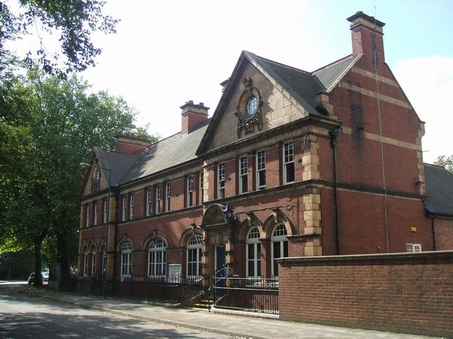

Darlaston is a town in the Metropolitan Borough of Walsall in the West Midlands of England.On January 1, 1895, Darlaston became an urban district, and the local board became Darlaston Urban District Council. In 1966, Darlaston became part of the County Borough of Walsall and in 1974, together with the rest of Walsall, it became part of the metropolitan county of the West Midlands.
The town grew in the 19th century around the nut, bolt and gun lock manufacturing and coal mining industries. It was highly industrialised with a population of 6,000 in 1841. Large areas of land were owned by the Birmingham Coal Company and the area was accessed by the Birmingham Canal Navigations and Grand Junction Railway
The town is served by one large secondary school - Darlaston Community School - which has specialist Science College status. The school was later taken over by businessman Bob Edminson and was turned into Grace Academy in 2009 and is the third Grace Academy. Since the early 1970s, the town centre has been by-passed by St Lawrence's Way, which runs between The Green and Bull Stake.
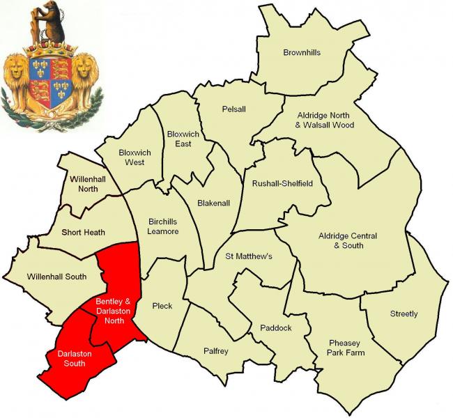
The principal neighbourhoods in the urban district today include: Rough Hay, The Leys, Moxley, Kings Hill, Woods Bank, Darlaston Green, The Flatts & Bentley which is a large suburban area occupying the northern part of the town.
for more on the histroy of darlaston see @ :
www.localhistory.scit.wlv.ac.uk/articles/Darlaston/Darl...
for the Walsall borough wards boundary maps used in drawing the attached polygon see @:
cms.walsall.gov.uk/index/council_and_democracy/election...
The town grew in the 19th century around the nut, bolt and gun lock manufacturing and coal mining industries. It was highly industrialised with a population of 6,000 in 1841. Large areas of land were owned by the Birmingham Coal Company and the area was accessed by the Birmingham Canal Navigations and Grand Junction Railway
The town is served by one large secondary school - Darlaston Community School - which has specialist Science College status. The school was later taken over by businessman Bob Edminson and was turned into Grace Academy in 2009 and is the third Grace Academy. Since the early 1970s, the town centre has been by-passed by St Lawrence's Way, which runs between The Green and Bull Stake.
The principal neighbourhoods in the urban district today include: Rough Hay, The Leys, Moxley, Kings Hill, Woods Bank, Darlaston Green, The Flatts & Bentley which is a large suburban area occupying the northern part of the town.
for more on the histroy of darlaston see @ :
www.localhistory.scit.wlv.ac.uk/articles/Darlaston/Darl...
for the Walsall borough wards boundary maps used in drawing the attached polygon see @:
cms.walsall.gov.uk/index/council_and_democracy/election...
Wikipedia article: http://en.wikipedia.org/wiki/Darlaston
Nearby cities:
Coordinates: 52°34'26"N 2°2'11"W
- Walsall 7.6 km
- Sutton Coldfield 11 km
- Telford 39 km
- Leicester 57 km
- Nottingham 70 km
- Metropolitan Borough of Stockport 97 km
- Warrington 105 km
- Doncaster 123 km
- Huddersfield 124 km
- York 170 km
- Grace Academy Darlaston grounds 1 km
- St Thomas More Catholic School grounds 1.1 km
- James Bridge Cemetery 1.2 km
- River Point Estate 1.2 km
- Kings Hill Park 1.4 km
- Wednesbury Cemetery 1.5 km
- Wednesbury Tube 2 km
- Post Codes WV12 & WV13 2.9 km
- Walsall (Metropolitan Borough of) 5.4 km
- Sandwell 6.9 km