Fort Richardson State Park, Historic Site.
USA /
Texas /
Jacksboro /
World
/ USA
/ Texas
/ Jacksboro
World / United States / Texas
site - to be removed, park, place with historical importance, state park
Ft. Richardson State Park, Historic Site & Lost Creek Reservoir State Trailway, located northwest of Fort Worth in Jack County, contains 454.16 acres. The property was acquired in 1968 from the City of Jacksboro and was opened to the public the same year.
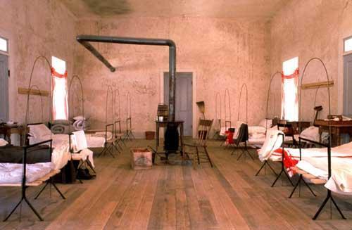
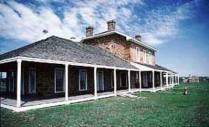
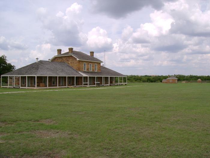
Fort site structures include seven of the original buildings which have been restored: the post hospital; the officers' quarters (Commanding Officer); a powder magazine; a morgue; a commissary; a guardhouse; and a bakery, which baked 600 loaves per day. There are also two replicas: officers' and enlisted men's barracks. The officers' barracks houses the Interpretive Center. Activities include historical study, picnicking, camping, fishing, hiking, biking, day-use equestrian, nature study, wading in the creek (seasonal), and swimming (accessible via Lost Creek Reservoir State Trailway or by road). Tours/Events: Guided historical tours are held daily at 10 am and 2 pm; tour fees apply.
www.tpwd.state.tx.us/spdest/findadest/parks/fort_richar...
Wikipedia article: http://en.wikipedia.org/wiki/Fort_Richardson,_Texas
Nearby cities:
Coordinates: 33°12'10"N 98°9'39"W
- Los Marranos 772 km
- Salinas Victoria 841 km
- Apodaca 847 km
- Cerro de Las Mitras 859 km
- Laguna de Sanchez 898 km
- La Petaca 937 km
- Cuesta de Lleras 1098 km
- Dolores Hidalgo 1367 km
- Helendale RCS Facility 1774 km
- Plains of Abraham (Plaines d'Abraham) 2729 km
- Oakwood Cemetery 2.8 km
- Jacksboro High School 3.2 km
- Jacksboro Municipal Airport 3.2 km
- Jacksboro Golf & Country Club 4.9 km
- John R Richards State Prison 5 km
- Keechi Wind Farm 5.8 km
- Lake Jacksboro Dam 5.9 km
- Senate Wind Farm 20 km
- Jermyn, Texas 22 km
- Bryson Lake 23 km