Zaporizhzhya Sich (Zaporizhzhia)
Ukraine /
Zaporizka /
Zaporizhzhya /
Zaporizhzhia
World
/ Ukraine
/ Zaporizka
/ Zaporizhzhya
, 11 km from center (Запоріжжя)
World / Ukraine / Zaporizhzhya
open air museum, interesting place
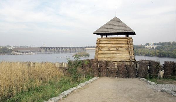
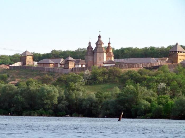
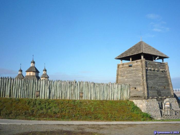
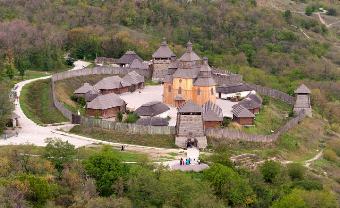
The natural, geographical and historical conditions of XV-XVI cc. were favorable for the formation within region of the «Zaporizhzhya Cossacks». Khortitsia island, which is known from the times of Old Russia, became one of its strongholds and symbols.
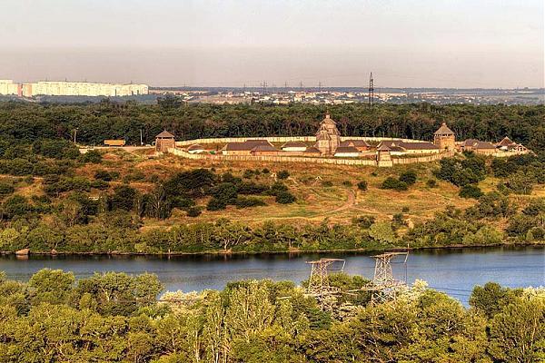
A great significance for Ukraine had the formation from separate Cossack detachments and industrial artels of social, political and military organization of Zaporizhzhya Cossacks – Zaporizhzhya Sich.
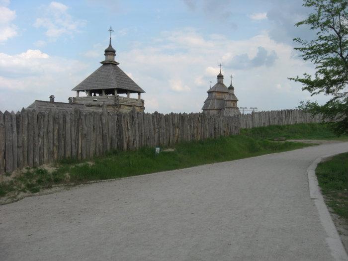
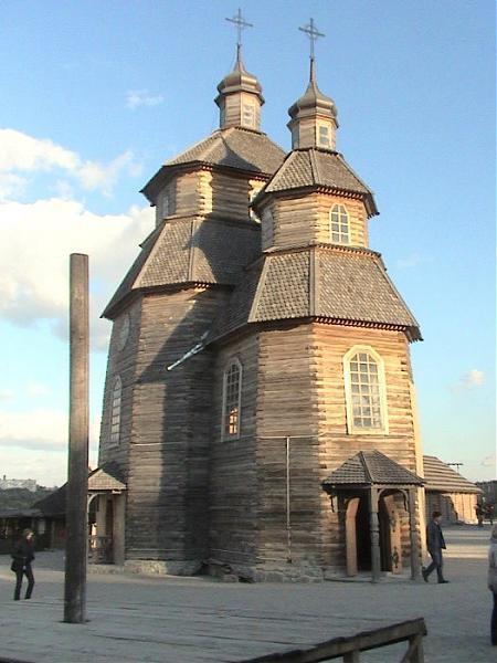
The Zaporizhian Sich was the fortified capital of the Zaporizhian Cossacks in the 16th to 18th century area of Ukraine and was located on the Dnieper River. The Sich Rada was the highest branch of government in the Zaporizhian Host or army of the Zaporizhian Cossacks. The Danubian Sich was the fortified settlement of the Zaporozhian Cossacks who later settled in the Danube Delta.
Zaporizhzhya Sich was the first political formation within territory of Ukraine with all attributes of a republic. It stayed independent for a long time and took an outstanding place in the international relations. European countries established the diplomatic relations and looked for its military assistance.
A great significance for Ukraine had the formation from separate Cossack detachments and industrial artels of social, political and military organization of Zaporizhzhya Cossacks – Zaporizhzhya Sich.
The Zaporizhian Sich was the fortified capital of the Zaporizhian Cossacks in the 16th to 18th century area of Ukraine and was located on the Dnieper River. The Sich Rada was the highest branch of government in the Zaporizhian Host or army of the Zaporizhian Cossacks. The Danubian Sich was the fortified settlement of the Zaporozhian Cossacks who later settled in the Danube Delta.
Zaporizhzhya Sich was the first political formation within territory of Ukraine with all attributes of a republic. It stayed independent for a long time and took an outstanding place in the international relations. European countries established the diplomatic relations and looked for its military assistance.
Nearby cities:
Coordinates: 47°51'26"N 35°4'29"E
- Dnipro/Dnieper Hydroelectric Dam 1.8 km
- prospekt Metalurhiv, 2 2.5 km
- vulytsia Nezalezhnoi Ukrainy, 31 2.6 km
- Beach "Baghdad" or Touristic Beach 3.1 km
- Zaporizhzhian daily Art exhibition 4.2 km
- Zaporizhia 700-year-old oak 5.9 km
- Zaporozhye Cossacks' Equestrian Theatre 7.7 km
- Tomakovka Island 45 km
- "Mamay mount" 76 km
- Tok's waterfall on Kam'yanka river, it is very wonderful place in south-ukraine steppe!!! 87 km
- Durna ('Stupid') Crag 0.6 km
- The powerline crossing 330kV 0.8 km
- Дамба 0.8 km
- The powerline crossing 150kV 0.9 km
- Abandoned cement-works 0.9 km
- Mechanization and Transport Service 1.4 km
- Voznesenivskyi District 4 km
- Dniprovskyi raion 4.2 km
- Khortytsia Island 4.8 km
- Zaporizhzhia Raion 5.5 km