Weston Mill Viaduct (Plymouth)
United Kingdom /
England /
Torpoint /
Plymouth /
B3396 Saltash Road
World
/ United Kingdom
/ England
/ Torpoint
World / United Kingdom / England
railway bridge, viaduct (bridge construction style)


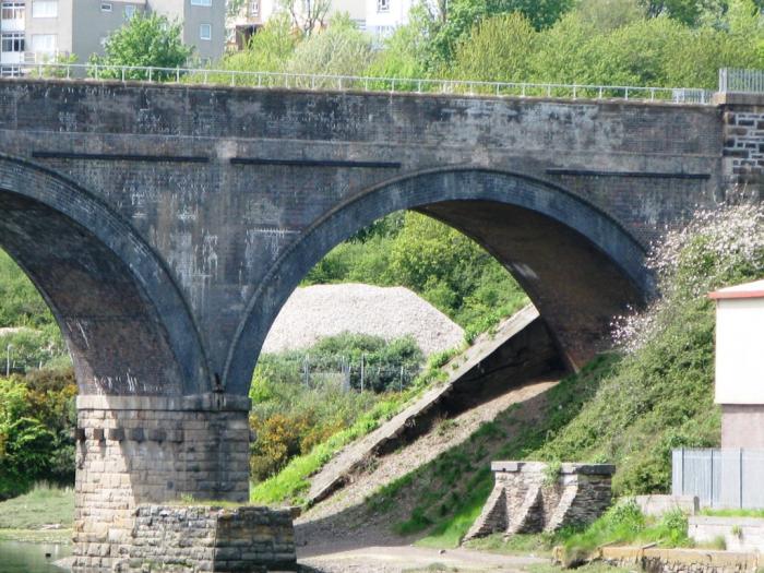
A Class C viaduct across Weston Mill Lake (Camel's Head creek in some sources), a wide tidal inlet between Keyham and St Budeaux stations. The viaduct is 46 feet high and 1,200 feet long. The original wooden structure on 29 trestles designed by Isambard Kingdom Brunel was replaced in 1903 with short brick viaducts either side of a four-span bowstring steel girder structure.-Adapted from Wikipedia.
Photos:
1) www.geograph.org.uk/photo/1709044
2) www.geograph.org.uk/photo/1709064
3) www.geograph.org.uk/photo/73417
4) commons.wikimedia.org/wiki/File:Weston_Mill_Viaduct_nor...
Photos:
1) www.geograph.org.uk/photo/1709044
2) www.geograph.org.uk/photo/1709064
3) www.geograph.org.uk/photo/73417
4) commons.wikimedia.org/wiki/File:Weston_Mill_Viaduct_nor...
Wikipedia article: https://en.wikipedia.org/wiki/Cornwall_Railway_viaducts#Weston_Mill
Nearby cities:
Coordinates: 50°23'41"N 4°10'56"W
- Royal Albert Bridge 2.4 km
- Tavy Bridge 4.4 km
- Calstock Viaduct 12 km
- Bolitho Viaduct 20 km
- Liskeard Viaduct 21 km
- Truro Viaduct 64 km
- Carvedras Viaduct 64 km
- Carnon Viaduct 68 km
- Redruth Viaduct 77 km
- Angarrack Viaduct 89 km
- Keyham 1 km
- HMNB Devonport 1.4 km
- Stoke 1.9 km
- Thanckes Oil Fuel Depot 1.9 km
- Devonport Park 2.2 km
- Devonport Park 2.2 km
- Saltash.net Community School 2.7 km
- Antony House 3.3 km
- HMS Raleigh 3.6 km
- Cornwall 54 km
Comments