fort Iluraton
Ukraine /
Krym /
Mykhaylivka /
World
/ Ukraine
/ Krym
/ Mykhaylivka
, 4 km from center (Михайлівка)
World / Ukraine / Crimea
place with historical importance, archaeological site, hillfort, open air museum, interesting place, historic ruins, object of cultural heritage of federal importance (Russia), tourist attraction
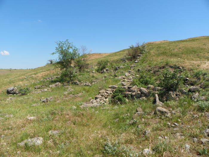
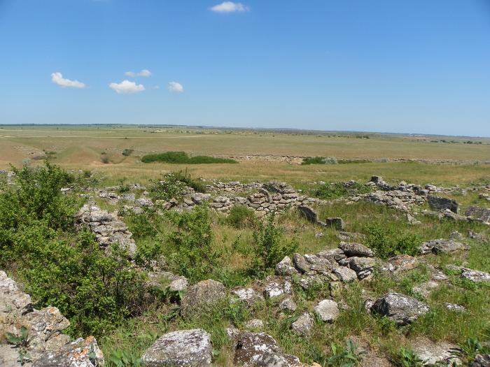
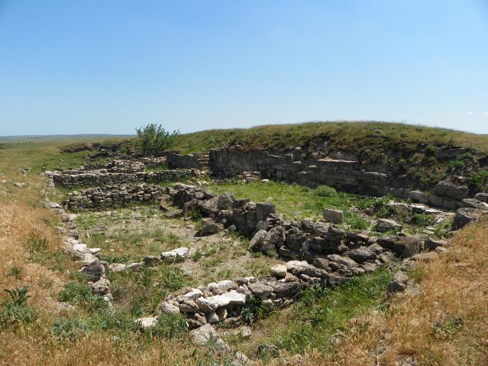
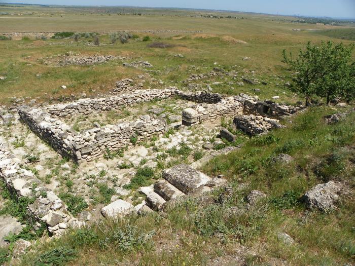
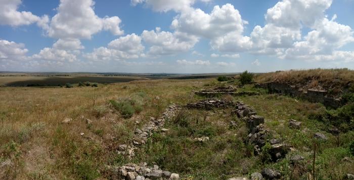
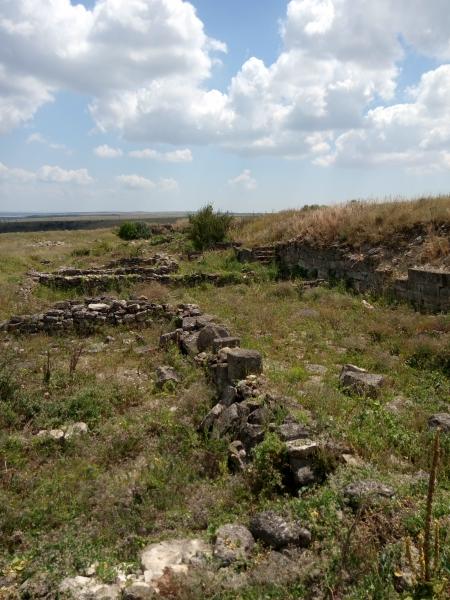
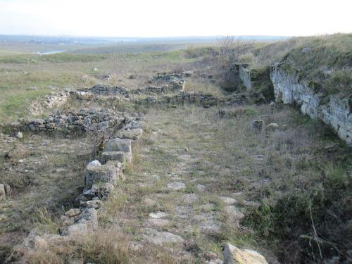
Iluraton: A Fortress of the 1st- 3rd centuries AD on the European Kimmerian Bosporos
In the first centuries AD a number of fortresses were constructed to the west of Panticapaeum, the capital of the Bosporan kingdom. Iluraton is the best known and best preserved archaeological of them all. It is located 17 km to the southwest of Kertch near modern village of Ivanovka (former Kermesh-Kelechik) and covers about 3 hectares. The thickness of strata on the site is not uniform. Near the defensive walls they reach 3,5 m, but in the centre of fortress the thickness lessens to 0,6 m.......more information you can get here: ilurat.nw.ru/content/index.htm .....
In the first centuries AD a number of fortresses were constructed to the west of Panticapaeum, the capital of the Bosporan kingdom. Iluraton is the best known and best preserved archaeological of them all. It is located 17 km to the southwest of Kertch near modern village of Ivanovka (former Kermesh-Kelechik) and covers about 3 hectares. The thickness of strata on the site is not uniform. Near the defensive walls they reach 3,5 m, but in the centre of fortress the thickness lessens to 0,6 m.......more information you can get here: ilurat.nw.ru/content/index.htm .....
Nearby cities:
Coordinates: 45°17'7"N 36°17'32"E
- Южный пер., 3 0.6 km
- Восточная ул., 4 0.7 km
- Виноградная ул., 2 1 km
- Cemetery 1.3 km
- Fish pond 4.5 km
- Andriivskyi Stavok (pond) 5.9 km
- Центральная ул., 19 5.9 km
- Andreyevka Stow 6.4 km
- Cemetery 6.8 km
- Adzhiel ravine 14 km