Vatta Kottai (Circular Fort)
India /
Tamil Nadu /
Kanniyakumari /
World
/ India
/ Tamil Nadu
/ Kanniyakumari
World / India / Tamil Nadu / Kanniyakumari
fortification, interesting place


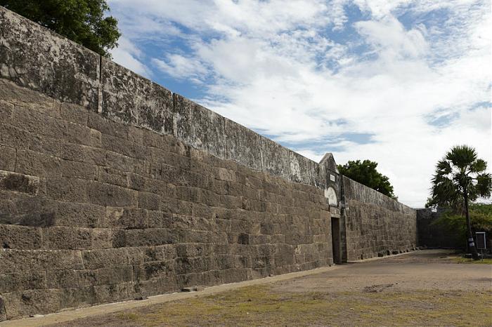

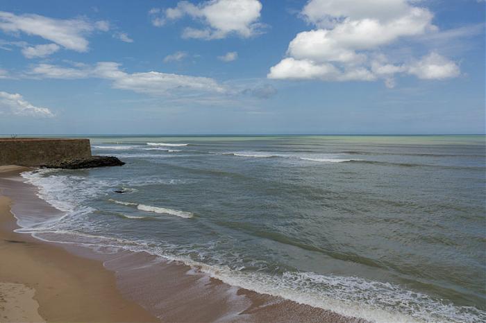
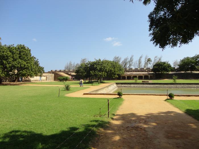
This information is provided by Archelogical Survey of India. The Vattakottai fort lies 18 kms from Nagarkoil in Agastheeswaram taluk of Dt. Kanyakumari. It is about 7 kms from Kanyakumari. The word is derived from the Tamil word 'Vattam' (Circle). This fort was reconstructed in the 18th century by the Venad kings of Travancore. Originally, a brick fort it was strengthened by the Dutch Army General De'Lanoy with Granite stone. The British troops in 1809 did not destroy the present fort. All the four sides of the inner fortification are provided with simple pillared mandapa with flat roof.
It is persumed that this fort was a military base to protect Kumari port, which was a 'pearl' harbor. The inner bastion is accessible by a ramp built of granite slabs. It is flanked by flight of steps to faciilitate the transport of cannons. The entire outer vaneer of the fort has well dressed granite blocks.
The main entrance has arched decorations on the top with emblem of Travancore Raja. At the centre of the fort there is a small tank, which supplied perennially water to the personnel in the fort.
The walls are 7.62 m high. The depiction of fish design on the ceiling of the mandapa inside the fort led some scholars to think to trace its origin to Pandya Kings (12th Century A.D.)
It is one of the most popular tourist destinations in Tamil Nadu.
This is a centrally protected monument under the control of Archelogical Survey of India since 1966.
kanyakumaritourism.in/vattakottai-fort-kanyakumari
Wikipedia article: http://en.wikipedia.org/wiki/Vattakottai_Fort
Nearby cities:
Coordinates: 8°7'32"N 77°33'55"E
- Swami Vivekananda Rock memorial 5.4 km
- Bay Watch 5.9 km
- West End Beach of Kanyakumari 6.4 km
- Rocky area of Muttom Beach 28 km
- Udayagiri Fort 29 km
- Padmanabhapuram Palace 30 km
- Palliyadi Sky Rock 38 km
- Mathur Aquaduct - Hanging Bridge 38 km
- E.M.S Colony, Poovar 59 km
- Poovar 60 km
- Pearl Krish Cricket Stadium 0.7 km
- ROHINI COLLEGE OF ENGINEERING 1.1 km
- Sabari coconut farm 1.6 km
- S G M Vincent Coconut Farm 2.2 km
- Anjugramam Pond 2.3 km
- S R Suresh Kumar'S Coconut Plantation 2.6 km
- Kannankulam beach 3.6 km
- Kuttappuli Beach 4.5 km
- Sea 15 km
- Sea 33 km
Comments