Ukarwahi Reservior
India /
Maharashtra /
Umred /
World
/ India
/ Maharashtra
/ Umred
World / India / Maharashtra / Nagpur
reservoir, dam
उकारवाही तलाव
Information about Ukarwahi Irrigation Project.
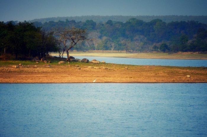
Official Designation of Ukarwahi Dam Irrigation Project is "Ukarwahi Dam , D - 04956 " . However local and popular name is " Ukarwahi Lake / Ukarwahi Talav ".Ukarwahi Irrigation Project is constructed as part of irrigation project by the Government of Maharashtra. It was completed in 1984. It is built on a Local Nallah near city of Umrer in Nagpur District of Maharashtra . The dam is an Earth fill dam .The length of dam is 820 m ( 2690.29 ft ) , while the height of the dam above lowest foundation is 14.14 m ( 46.3910 feet ) . Project has a Spillway of Ogee type.Length of the spillway is not known, the spillway is un-gated.Its catchment area is not known .Maximum / Gross storage capacity is 1.983 MCM. Live storage capacity is not known. Now a days almost all the water bodies make for good picnic spots and so does this place.
Information about Ukarwahi Irrigation Project.
Official Designation of Ukarwahi Dam Irrigation Project is "Ukarwahi Dam , D - 04956 " . However local and popular name is " Ukarwahi Lake / Ukarwahi Talav ".Ukarwahi Irrigation Project is constructed as part of irrigation project by the Government of Maharashtra. It was completed in 1984. It is built on a Local Nallah near city of Umrer in Nagpur District of Maharashtra . The dam is an Earth fill dam .The length of dam is 820 m ( 2690.29 ft ) , while the height of the dam above lowest foundation is 14.14 m ( 46.3910 feet ) . Project has a Spillway of Ogee type.Length of the spillway is not known, the spillway is un-gated.Its catchment area is not known .Maximum / Gross storage capacity is 1.983 MCM. Live storage capacity is not known. Now a days almost all the water bodies make for good picnic spots and so does this place.
Nearby cities:
Coordinates: 20°56'21"N 79°15'3"E
- Wadgaon Dam Reservoir 24 km
- Gosikhurd Dam, Spillway and Reservoir. 29 km
- Pothara Dam,Spillway and Reservoir. 46 km
- Bawanthadi(Rajiv Sagar) Dam ,spillway and Reservoir. 77 km
- Irai Dam Reservoir 79 km
- Asolamendha Dam,Spillway and Reservoir. 91 km
- Itiadoh Dam , Spillway and Reservoir. 94 km
- Sirpur Medium Irrigation Project. 121 km
- mogra barrage 142 km
- Khairkatta Dam 161 km
- coal tar processing factory 1.1 km
- Topworth Urza Metal &Steel Ltd. 1.8 km
- Apsara Talab 3.1 km
- Velsakhra 3.4 km
- sunderban 4.5 km
- New Coal Mine Site 6.9 km
- Coal mines 8.5 km
- Shirpur 9 km
- माता कांझरी तलाव ,Mata kajhari Lake 12 km
- Lohara Talav 14 km