Netrokona District Town
| city, third-level administrative division, town district
Bangladesh /
Netrakona /
World
/ Bangladesh
/ Netrakona
/ Netrakona
World / Bangladesh / Dhaka / Mymensingh / Netrakona
city, third-level administrative division, town district
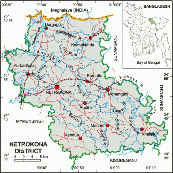
Netrokona District (Dhaka division) with an area of 2810.40 km sq km, is bounded by Garo Hills of Meghalaya (India) on the north, kishoreganj district on the south, Sunamganj district on the east and Mymensingh district on the west. Annual temperature; Average maximum 33.3°C and minimum 12°C. Total rainfall 2174 mm. Main rivers are Someshwari, Kangsha, Magra, Dhanu, Dhala, Teorkhali.
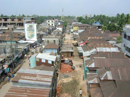
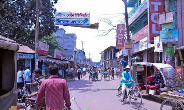
Netrokona (Town) consists of 9 wards and 33 mahallas. It is a municipal town with an area of 13.63 sq km. The town has a population of 53853; male 51.22%, female 48.78%. The density of population is 3951 per sq km. Literacy rate among the town people is 54.2%
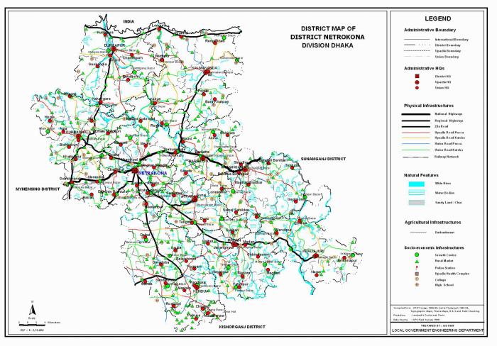
Netrokona subdivision was established in 1882 and was turned into a district in 1984. The district consists of 10 upazilas, 4 municipalities, 36 wards, 102 mahallas, 85 union parishads and 2281 villages. The upazilas are atpara, barhatta, durgapur, khaliajuri, kalmakanda, kendua, madan, mohanganj, netrokona sadar and purbadhala; municipalities are Barhatta, Durgapur, Mohanganj and Netrokona Sadar.
Archaeological heritage and relics: Roail Bari Fort at Kendua, Khoja dighi (pond), palace of Maharaja at Susang Durgapur, dighi of Kamol Rani, Buddhist Math at Krishnapur of Atpara and the archaeological relics of Salki Matikata.
Historical events: During the British rule peasant revolt, Pagalpanthi revolt, Tonk and Tebhaga movements took place in the district. The leaders of the Swadeshi Movement killed Balak Saha of Village Borail in 1913 and Zamindar Mallick Bahadur of village Sahildeo in 1930 and looted their wealth. The three day All India Peasant Conference was held in Nagara of the district head quarters in 1945.
Population 1937794; male 50.71%, female 49.29%; Muslim 83%, Hindu 14% and others 3%.
Religious institutions Mosque 2013, temple 728, church 7 and tomb 40, sacred place 2.
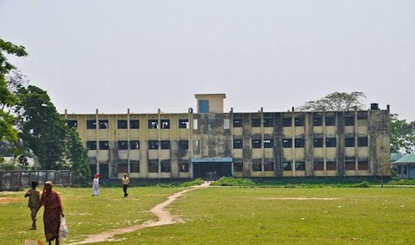
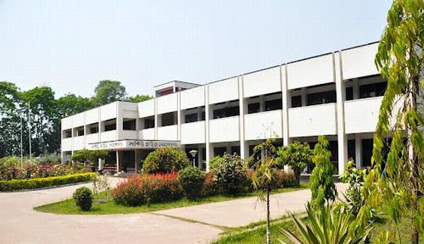
Literacy and educational institutions Average literacy 26%, male 31.2% and female 20.4%. Educational institutions: government college 2, non-government college 17, government high school 5, non-government high school 106, junior high school 44, madrasa 77, government primary school 634, non-government primary school 478, primary teacher's training institute 2, law college 1, nursing institute 1, Sanskrit college 1, homeopathy college 1, technical institute 1, music school
Cultural organisations Club 18, public library 6, open stage 1, theatre group 5, opera party 7, circus party 1, literary society 6, women's organisation 4, cinema hall 15, auditorium 2, shilpakala academy 1, tribal cultural academy 1, cultural institutions 76, sports organisation 43.
Main occupations Agriculture 52.05%, fishing 1.87%, agricultural labourer 21.97%, wage labourer 3.09%, commerce 7.61%, service 2.94% and others 10.47%.
Land use Total cultivable land 207608.26 hectares; fallow land 15702.14 hectares; single crop 29.5%, double crop 55% and treble crop land 15.5%; land under irrigation 55%.
Land control Among the peasants 22.23% are landless, 29.87% marginal, 24.35% small, 17.67% intermediate and 5.88% rich.
Fisheries, dairies, poultries Dairy 102, poultry 912 and hatchery 4.
Communication facilities Roads: pucca 155 km, semi pucca 75 km and mud road 303; railways 66 km; waterways 174 nautical mile
Cottage industries Bidi work, ice factory, oil mill, tailoring etc.
NGO activities Operationally important NGOs are CARE, brac, grameen bank, asa, Concern Bangladesh, Swabalambi, Nari Pragati Sangha, SCI.
Health centres Modern hospital 1, upazila health complex 10, maternity hospital 1, health and family welfare centre 48, leprosy and tuberculosis hospital 1, eye hospital 1, diabetic hospital 1, red crescent hospital 1, heart foundation 1, family health services clinic 1, nursing home 1, mission hospital 1, destitute health centre 1.
Netrokona (Town) consists of 9 wards and 33 mahallas. It is a municipal town with an area of 13.63 sq km. The town has a population of 53853; male 51.22%, female 48.78%. The density of population is 3951 per sq km. Literacy rate among the town people is 54.2%
Netrokona subdivision was established in 1882 and was turned into a district in 1984. The district consists of 10 upazilas, 4 municipalities, 36 wards, 102 mahallas, 85 union parishads and 2281 villages. The upazilas are atpara, barhatta, durgapur, khaliajuri, kalmakanda, kendua, madan, mohanganj, netrokona sadar and purbadhala; municipalities are Barhatta, Durgapur, Mohanganj and Netrokona Sadar.
Archaeological heritage and relics: Roail Bari Fort at Kendua, Khoja dighi (pond), palace of Maharaja at Susang Durgapur, dighi of Kamol Rani, Buddhist Math at Krishnapur of Atpara and the archaeological relics of Salki Matikata.
Historical events: During the British rule peasant revolt, Pagalpanthi revolt, Tonk and Tebhaga movements took place in the district. The leaders of the Swadeshi Movement killed Balak Saha of Village Borail in 1913 and Zamindar Mallick Bahadur of village Sahildeo in 1930 and looted their wealth. The three day All India Peasant Conference was held in Nagara of the district head quarters in 1945.
Population 1937794; male 50.71%, female 49.29%; Muslim 83%, Hindu 14% and others 3%.
Religious institutions Mosque 2013, temple 728, church 7 and tomb 40, sacred place 2.
Literacy and educational institutions Average literacy 26%, male 31.2% and female 20.4%. Educational institutions: government college 2, non-government college 17, government high school 5, non-government high school 106, junior high school 44, madrasa 77, government primary school 634, non-government primary school 478, primary teacher's training institute 2, law college 1, nursing institute 1, Sanskrit college 1, homeopathy college 1, technical institute 1, music school
Cultural organisations Club 18, public library 6, open stage 1, theatre group 5, opera party 7, circus party 1, literary society 6, women's organisation 4, cinema hall 15, auditorium 2, shilpakala academy 1, tribal cultural academy 1, cultural institutions 76, sports organisation 43.
Main occupations Agriculture 52.05%, fishing 1.87%, agricultural labourer 21.97%, wage labourer 3.09%, commerce 7.61%, service 2.94% and others 10.47%.
Land use Total cultivable land 207608.26 hectares; fallow land 15702.14 hectares; single crop 29.5%, double crop 55% and treble crop land 15.5%; land under irrigation 55%.
Land control Among the peasants 22.23% are landless, 29.87% marginal, 24.35% small, 17.67% intermediate and 5.88% rich.
Fisheries, dairies, poultries Dairy 102, poultry 912 and hatchery 4.
Communication facilities Roads: pucca 155 km, semi pucca 75 km and mud road 303; railways 66 km; waterways 174 nautical mile
Cottage industries Bidi work, ice factory, oil mill, tailoring etc.
NGO activities Operationally important NGOs are CARE, brac, grameen bank, asa, Concern Bangladesh, Swabalambi, Nari Pragati Sangha, SCI.
Health centres Modern hospital 1, upazila health complex 10, maternity hospital 1, health and family welfare centre 48, leprosy and tuberculosis hospital 1, eye hospital 1, diabetic hospital 1, red crescent hospital 1, heart foundation 1, family health services clinic 1, nursing home 1, mission hospital 1, destitute health centre 1.
Nearby cities:
Coordinates: 24°52'19"N 90°43'32"E
- Habigonj District 44 km
- Sunamganj District 45 km
- Narsingdi District 71 km
- Maulvibazar District 90 km
- Sylhet District 97 km
- Khagrachari District 162 km
- Rangamati District 182 km
- Feni 186 km
- Bhola District Town 239 km
- Jiuzhaigou County 1579 km
- Netrakona Sadar Upazila 3.5 km
- Atpara Upazila 15 km
- Barhatta Upazila 18 km
- Durgapur Upazila 22 km
- Kalmakanda Upazila 26 km
- Mohangonj Upazila 31 km
- Dharmapasa Upazila 37 km
- Dhaka Division 90 km
- Meghalaya 96 km
- Sylhet Division 107 km