Bournville (Birmingham)
| suburb, Quaker faith / Society of Friends, town district, ward (administrative division)
United Kingdom /
England /
Birmingham
World
/ United Kingdom
/ England
/ Birmingham
World / United Kingdom / England
suburb, Quaker faith / Society of Friends, town district, ward (administrative division)
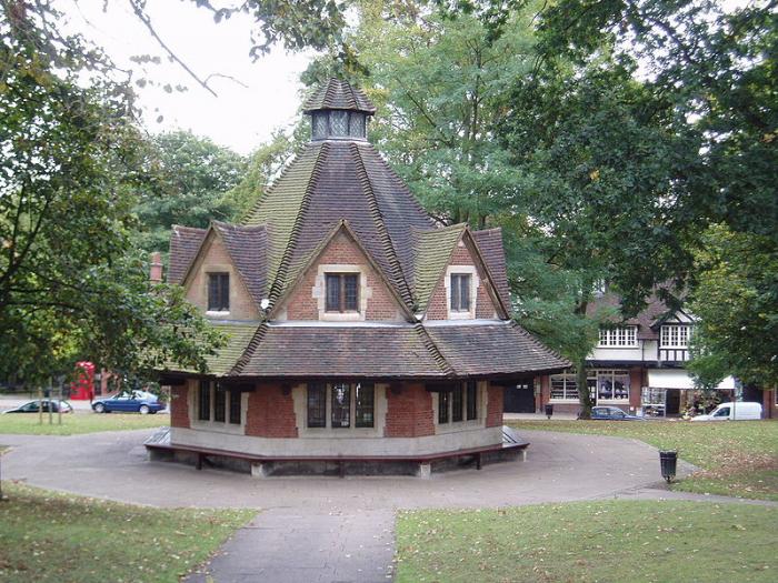
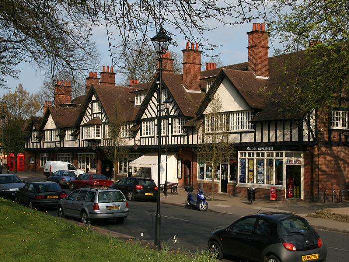
Bournville is a model village on the south side of Birmingham, England, best known for its connections with the Cadbury family and chocolate – including a dark chocolate bar branded "Bournville". It is also a ward within the Birmingham City council constituency of Selly Oak and a neighbourhood within that ward (attached polygon delineates the neighbourhood, which is obviously larger than the model village [separately tagged] but smaller than the electoral ward). It is home to the Bournville Centre for Visual Arts. Research by the Joseph Rowntree Foundation has claimed that it is "one of the nicest places to live in Britain"
Having taken over their father John Cadbury's expanding business in 1861, the Quakers George and Richard Cadbury needed to move their cocoa and chocolate factory from Bridge Street in central Birmingham to a greenfield site to allow for expansion. Cadbury were reliant on the canals for milk delivery, and on the railways for cocoa deliveries from the ports of London and Southampton. They therefore need a site which was undeveloped and had easy access to both canal and rail. The brothers noticed the proposed development of the Birmingham West Suburban Railway, which would extend from central Birmingham south along the path of the Worcester and Birmingham Canal into the then green fields of southern Birmingham and the villages of northern Worcestershire.
The Cadburys named the area 'Bournville' after the Bourn Brook (now known as The Bourn); with 'ville' being French for 'town', this set Bournville apart from the local area (some people wrongly believe Bournville was originally known as Bournbrook - Bournbrook exists as a separate area to the north of Bournville). Then Cadburys began to develop their factory in the new suburb. Loyal and hard-working workers were treated with great respect and relatively high wages and good working conditions; Cadbury also pioneered pension schemes, joint works committees and a full staff medical service.
for Bournville Community Website see @:
www.bournville-web.net/
for large scale detailed download (pdf) map of Selly Oak constituency district, featuring Bournville neighbourhood boundary see @ :
www.birmingham.gov.uk/cs/Satellite?blobcol=urldata&blob...
Wikipedia article: http://en.wikipedia.org/wiki/Bournville
Nearby cities:
Coordinates: 52°25'32"N 1°56'29"W
- Headington 86 km
- Cowley 89 km
- West Reading 123 km
- Caversham 123 km
- Woodley 127 km
- Whitley 128 km
- Lower Earley 129 km
- Birch Hill 138 km
- Hillingdon 140 km
- Wimbledon 160 km
- Rowheath Playing Fields 0.4 km
- Bournville Village Conservation Area 0.6 km
- Manor Farm Park 1.4 km
- Selly Oak 2.5 km
- Shenley Academy grounds 2.5 km
- West Heath Park 2.6 km
- Ley Hill Recreation Ground 2.6 km
- Northfield 2.6 km
- Edgbaston 2.8 km
- Austin Village Conservation Area 3.5 km