Nahirtsi
Ukraine /
Kyyivska /
Prypyat /
World
/ Ukraine
/ Kyyivska
/ Prypyat
, 5 km from center (Припьять)
urochishte (stow)
Add category

A former village with 248 inhabitants, who were evicted due to the construction of the Chornobyl Nuclear Power Plant.
The village was demolished in 1974.
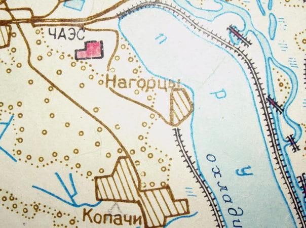
Nahirtsi was a former village in Ukraine, located in the Chornobyl district of Kyiv Oblast. Until 1978, it was administratively subordinate to the Kopachi village council.
In 1978, the residents were relocated to the village of Kopachi, and the area was flooded during the construction of the cooling pond for the Chornobyl Nuclear Power Plant.
The village was demolished in 1974.
Nahirtsi was a former village in Ukraine, located in the Chornobyl district of Kyiv Oblast. Until 1978, it was administratively subordinate to the Kopachi village council.
In 1978, the residents were relocated to the village of Kopachi, and the area was flooded during the construction of the cooling pond for the Chornobyl Nuclear Power Plant.
Nearby cities:
Coordinates: 51°22'34"N 30°8'21"E
- Boloto Topylo Range 6.6 km
- Korohodskyi Grove 14 km
- Stechanka 17 km
- Borovoye Field tract 19 km
- Potebneva Huta Stow 53 km
- Vedmezhyi Rih Stow 56 km
- Natural boundary Boloto Ostrygans'ke 68 km
- Yevminova Dacha Stow 76 km
- Velikoye Boloto Stow 78 km
- Ovroot Stow 83 km
- Polevaya base department of radioecology and Radiobiology 0.3 km
- Sediment 0.3 km
- Lake for cooling 0.7 km
- Ground TMC (Commodity Wealth) 0.8 km
- Canal for cooling 1.2 km
- Spent Nuclear Fuel Storage 1.4 km
- Chornobyl Nuclear Power Plant 1.9 km
- Cooling pond 2.6 km
- Chernobyl Cooling Pond Island 3.4 km
- Chornobyl Exclusion Zone 17 km